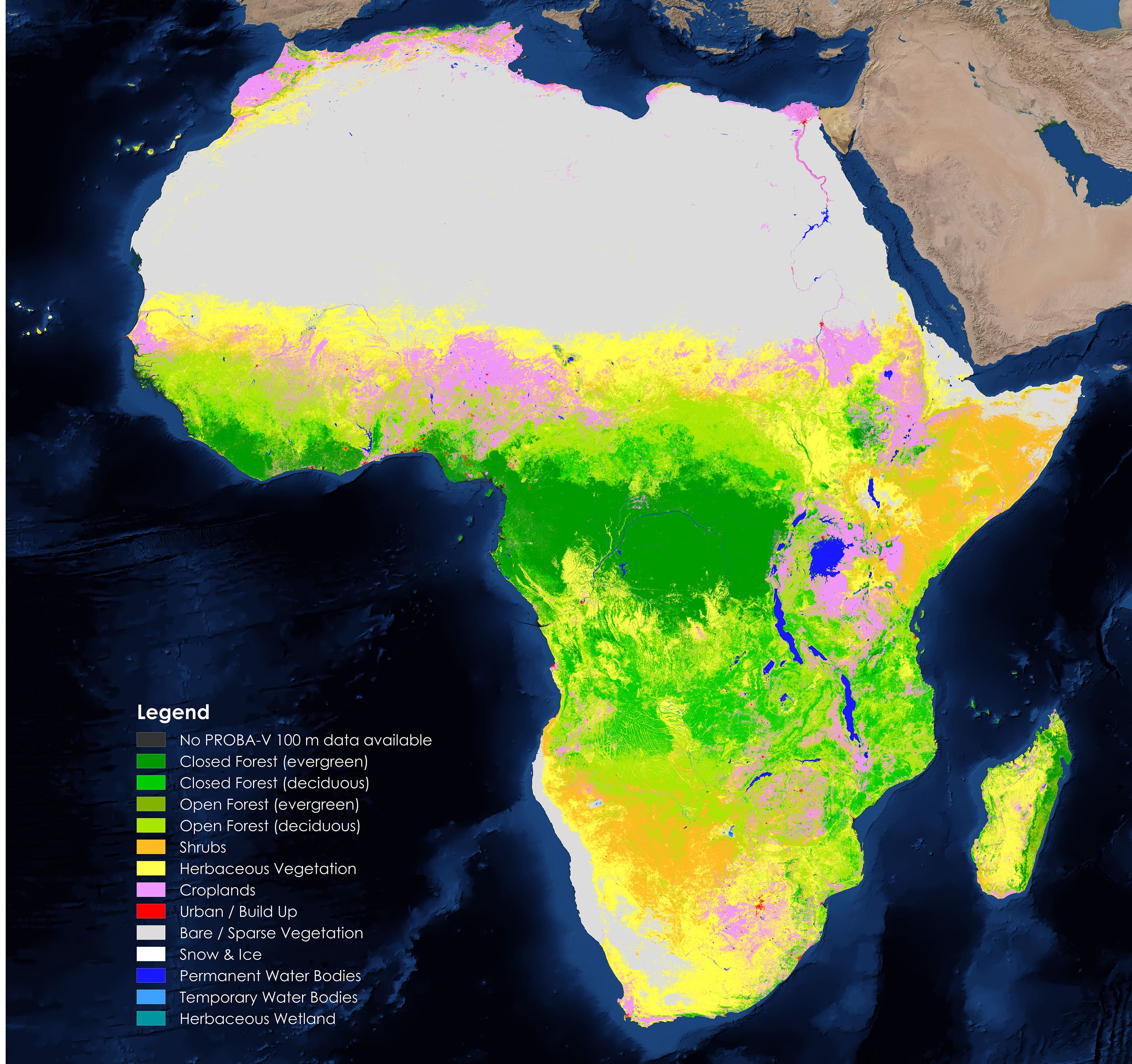
“At FAO we use the Copernicus Africa 100m map in WaPOR, our portal to monitor Water Productivity, and we are looking forward to integrate the new Copernicus global reference map and their yearly updates.”
Jippe Hogeveen
- Senior Land Water Officer, UN-FAO