Agriculture in the EU & the MARS Project
Given the post-war food scarcities, agriculture has always been a major focal point of the European Union. DG-AGRI, the European Ministry or “Directorate General” (DG) of Agriculture, is responsible for the definition and realization of a Common Agricultural Policy (CAP) amongst all the EU Member States.To take adequate and fair decisions, DG-AGRI needs reliable agro-statistics, acquired in a uniform and timely way over the different EU member states.To acquire the necessary agro-statistics, the EU has started the MARS project in 1988, under supervision of the Joint Research Centre (DG-JRC) in Ispra, Italy. It addresses different focal points:
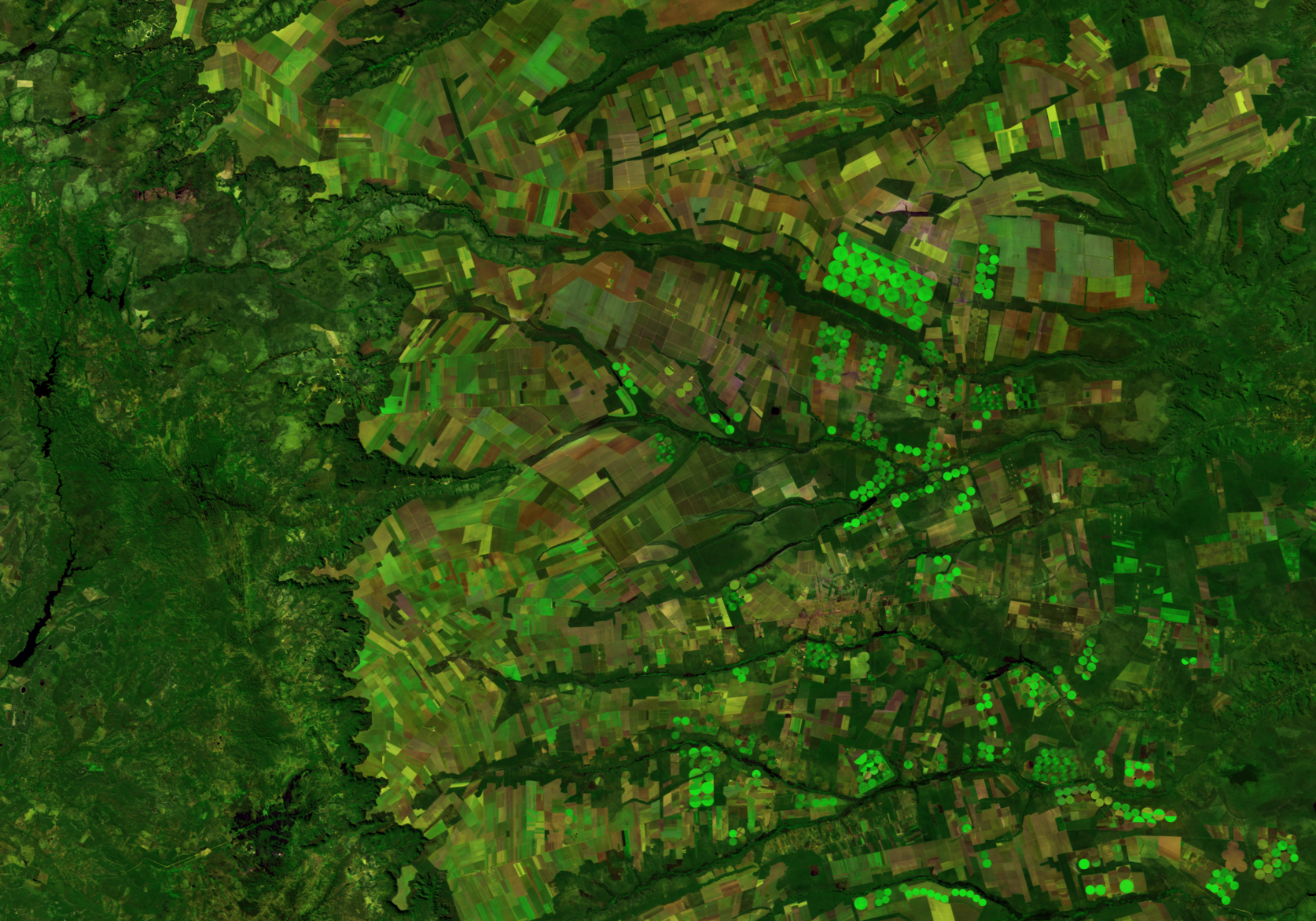
- Crop mapping and area estimation:
This action aims to determine the per-annual areas of the major crops within the EU. - Pre-harvest monitoring of the crop state and yield estimation:
Within-season yield estimates are of crucial importance for the world trade of food commodities. JRC-MARS provides this information on a European or global scale, via a combination of different resources (weather data, crop growth modelling, remote sensing, etc.) and distributes it to the major stakeholders around the world. - Derived actions:
The previous results (areas, yields) are used to deal with other issues, such as crop insurances and the impact of climate change.

YIELD ESTIMATION VIA MARS
The core of the JRC-MARS yield forecasting system is based on “models”: crop growth models or statistical methods. Both have the tendency to narrow down on the “normal behaviour”, but they often fail in the case of exceptional events. According to JRC, the “objective observations” of remote sensing often improve the final yield estimates.For the MARS-project, we collect imagery from different satellites to generate:
- Ten-daily composite images (smoothed to remove cloud noise)
- Vegetation indices such as NDVI, fAPAR, fCOVER and LAI
- Model based indices (integrating meteorological data), such as DMP
- Long Term Statistics and anomalies to show regions with growth retardation
- Databases with Regional Unmixed Means of the variables
- ISO-cluster maps, showing regions with similar behaviour

JRC MARS Bulletin September 2017 (Vol. 25 No 9)
MARS AND ITS IMPACT ON REMOTE SENSING
Over the years, at VITO the MARS-contracts have always stimulated the development of new approaches, for instance for- The processing of new satellites such as MODIS, METOP and MSG
- Data smoothing
- Extraction of phenological parameters (start/end of season)
- Image classification
- Yield estimation via similarity analysis
- The development of new software(GLIMPSE and SPIRITS)
- ...
SOFTWARE FOR POST-PROCESSING
Besides the various pre-processing workflows which upgrade the “raw” satellite registrations into 10-daily composites (S10), two software packages have been developed with focus on the further extraction of useful information from time series of such S10 composites.- GLIMPSE:
FromFrom the very beginning (2000), it was attempted to program all MARSOP procedures in a most generic way. That means: operational for any sensor, resolution, indicator, etc. Over the years this has resulted in a set of ANSI-C programs called GLIMPSE, all working in Command Line mode, which facilitates their incorporation into “scripts” and the setup of automated processing workflows. Today, GLIMPSE is also used in many other projects by JRC and VITO.
- SPIRITS:
SPIRITS is a JAVA-based software which allows to run the core of the GLIMPSE modules in a standard Windows environment. But it also provides a wealth of additional facilities, related to format conversions, database management, map generation, etc. SPIRITS has been developed on behalf of JRC-MARS. It is freely available and the latest version can always be downloaded from http://spirits.jrc.ec.europa.eu/. SPIRITS is used around the world to prepare agro-meteorological bulletins.

Find out more about the MARS programme, its history, goals and achievements in a special summary dedicated to its 25th anniversary.
/Blog_CORSA_1200x650.png)
/Blog_WorldCereal_1200x650.png)
/lewis-latham-0huRqQjz81A-unsplash.jpg)