collaborating with the agro-insurance sector
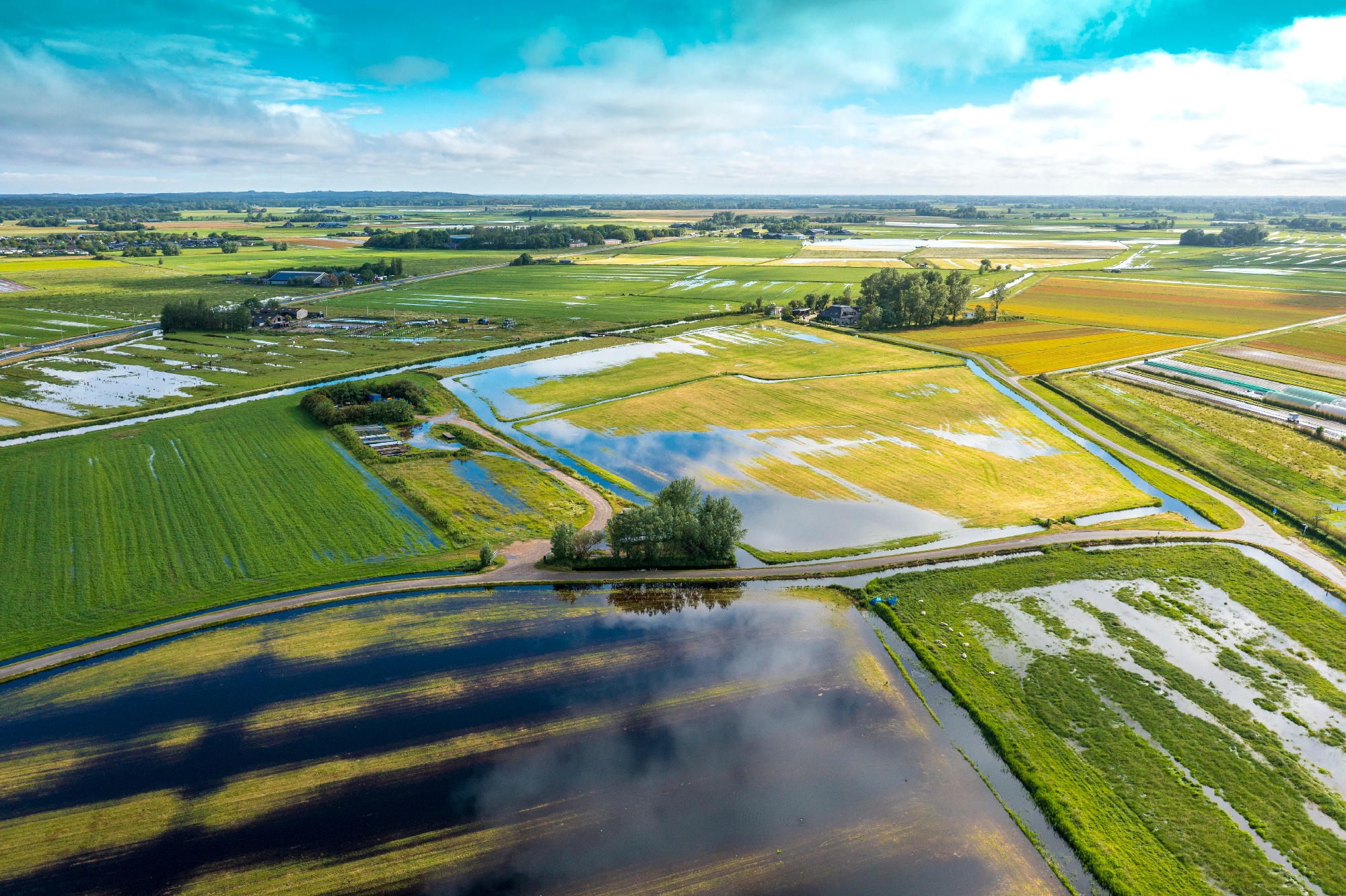
Remote sensing offers various solutions to support agro-insurance companies. The increased occurrence of extreme weather and natural disasters over the past years has put the agro-insurance sector under great pressure. Drought for example, requires loss adjusters to evaluate many fields spread over a large region in a short period of time. Insurance companies must keep up with customer demands when facing increased competition in a complex environment. They have to deal with new laws, more crops and perils to be insured, and new technologies that arise. But in order to provide a solution that meets the customer’s demand, we must understand the true needs of the insurance sector.
With more than 20 years of experience in offering EO-based solutions for global agricultural monitoring we’ve had the opportunity to develop several products and services for damage and risk assessment supporting agro-insurance and re-insurance companies active in Belgium, Morocco, Ethiopia, Kenya, Senegal and Ukraine. Together with IFAD, we explored how EO-based vegetation indices, rainfall and soil moisture products could replace ground data for setting up index insurances for smallholders in Sub-Saharan Africa.
In 2020 we defined EO Best Practice for Agro-Insurance in the EO4I project. Together with Geoville and AgroInsurance we checked how we could maximally exploit the use of EO products and services. Last year we joined the AgroInsurance International conference, an international event that brings together all kind of actors, from primary insurance companies to re-insurance companies, brokers, consulting agencies, state authorities, international organizations like WFP and technology service companies. It’s a fairly technical conference, where we discuss in depth solutions and opportunities for actual agro-insurance challenges. And in Belgium we have just started a collaboration with KBC, the largest agro-insurer in Belgium. Let me share a few trends with you.
Index insurance
Index insurance is one of the hot debate topics in the agro-insurance sector. Subjects like economic sustainability of running an index insurance program, challenges faced when developing index insurance products (e.g., definition of a smallholder, minimum field size or income of a farmer), the accuracy of the index and the basis risk, which new technologies are available and best suited are widely discussed among different actors in the agro-insurance sector. To share some insights on the role of EO into this, we ‘ve recently published a white paper together with AgroInsurance International and Geoville. This paper gives an overview of the different types of index insurance and the key challenges to develop and offer such insurance products. We also share best practices on the use of EO in index insurance, based on past experiences by the partners, as well as from literature and feedback we received from the insurance industry.
What about the future of index insurance? How will it look like? Will it be based purely on EO data, or EO data combined with meteorological data or perhaps even a hybrid solution with EO data continuously calibrated with real time data collected by loss adjusters in the field? Our expertise in both operational index development (e.g. in Ethiopia or Senegal) and across-scale data fusion (through ScaleAgData) will sure be part of it.
collaboration toolS
The uptake of Earth Observation data in agro-insurance companies goes hand in hand with the digitalization of business processes like loss adjustment and claim handling. In order to digitize and automate agro-insurance’s operational workflows it is crucial to use flexible and reliable tools that are able to provide a company-specific solution. As mentioned earlier, what works for one company, isn’t necessarily the solution for another company. A number of agro-insurance companies already have their own digital platforms and are simply looking for on-demand API’s to integrate data from various sources into their operational systems. These companies can use TerraScope’s EOplaza where we offer a broad range of EO data and derived products such as CropSAR cloud-free vegetation indices or historical variability maps.
In other collaborations, e.g. with the Belgian insurance company KBC, a co-design process was needed. For KBC we have tailored WatchITgrow, our platform to support agricultural monitoring, to align its features and functionalities to allow KBC to use it in their current business to operate weather-based agro-insurances in Belgium. And we also have MAPEO, another EO data processing tool, which allows us to integrate drone technology in WatchITGrow, making it possible to combine both satellite and drone imagery from one entry point. In the Ops-drone project for example, we are demonstrating the use of drone technology for loss adjustment, including a business case and workshop dedicated to agro-insurances.
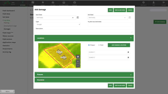
Printscreen of WatchITgrow, our platform to support agricultural monitoring, which was tailored for KBC to make it possible for them to use it in their current business to operate weather-based agro-insurances in Belgium.
New opportunities for EO in agro-insurance
The range of EO technologies is constantly increasing bringing new opportunities to serve the agro-insurance sector. But also, from within the sector, many new ideas and opportunities arise. Carbon removal technologies and activities for example are important tools in the fight against climate change. Stored carbon has an economic and transferable value and is getting in the picture of insurance and re-insurance companies. To insure carbon, questions like “Can sequestered carbon be accurately measured and quantified in case of a loss?" should be answered. Think of the case when a storm hits a forest, or when a major drought impacts a grassland, and carbon stocks decrease. Or the opposite: can we measure how much additional CO2 is captured in the soil thanks to carbon farming?
One key requirement is a good verification mechanism. Remote sensing should be part of this, e.g. by measuring both standing biomass as well as growth and losses, estimating soil organic carbon or identifying agricultural cropping patterns (e.g. the use of cover crops vs. bare soil, crop harvest detection, ... ). With projects like HR-VLCC (High-Resolution Layer Vegetated Land Cover Characteristics) and e-shape generating this information, we are looking forward to support the agro-insurance sector also on these topics.
Working with the agro-insurance sector is both challenging and interesting. Thanks to all interactions with the sector, we can steer our EO product and service development towards the needs of the agro-insurance industry.

/Blog%20Post%20Strip%20Cropping%20-%20Featured%20Image%201200x650%20150%20ppi.png)
/Blog_WorldCereal_1200x650.png)
/lewis-latham-0huRqQjz81A-unsplash.jpg)