A high demand for geo-information data
The European agro-insurance industry has drastically changed over the last decades. There has been a trend from single hail to multi-peril crop insurance, from national to European, from staple crops to a wide spectra of crops and from analogue to digital data. The result is that the industries’ portfolios are getting vaster and more divers, emphasising the need for digitalization. Travel restrictions due to the recent Covid pandemic have only stimulated the sector’s interest in remotely collected observations.
Remote sensing is clearly a part of the answer to this ever-growing demand of spatial information. There are many different EO based products on the market that are relevant for the agro-insurance industry, ranging from simple indices to higher level such as crop damage mapping or yield estimations. But it’s not only about what is available today, even more important is how these products fit in the agro-insurance company workflow, how to maximally exploit them and to define future developments.
Which EO data serves agro-insurance the best
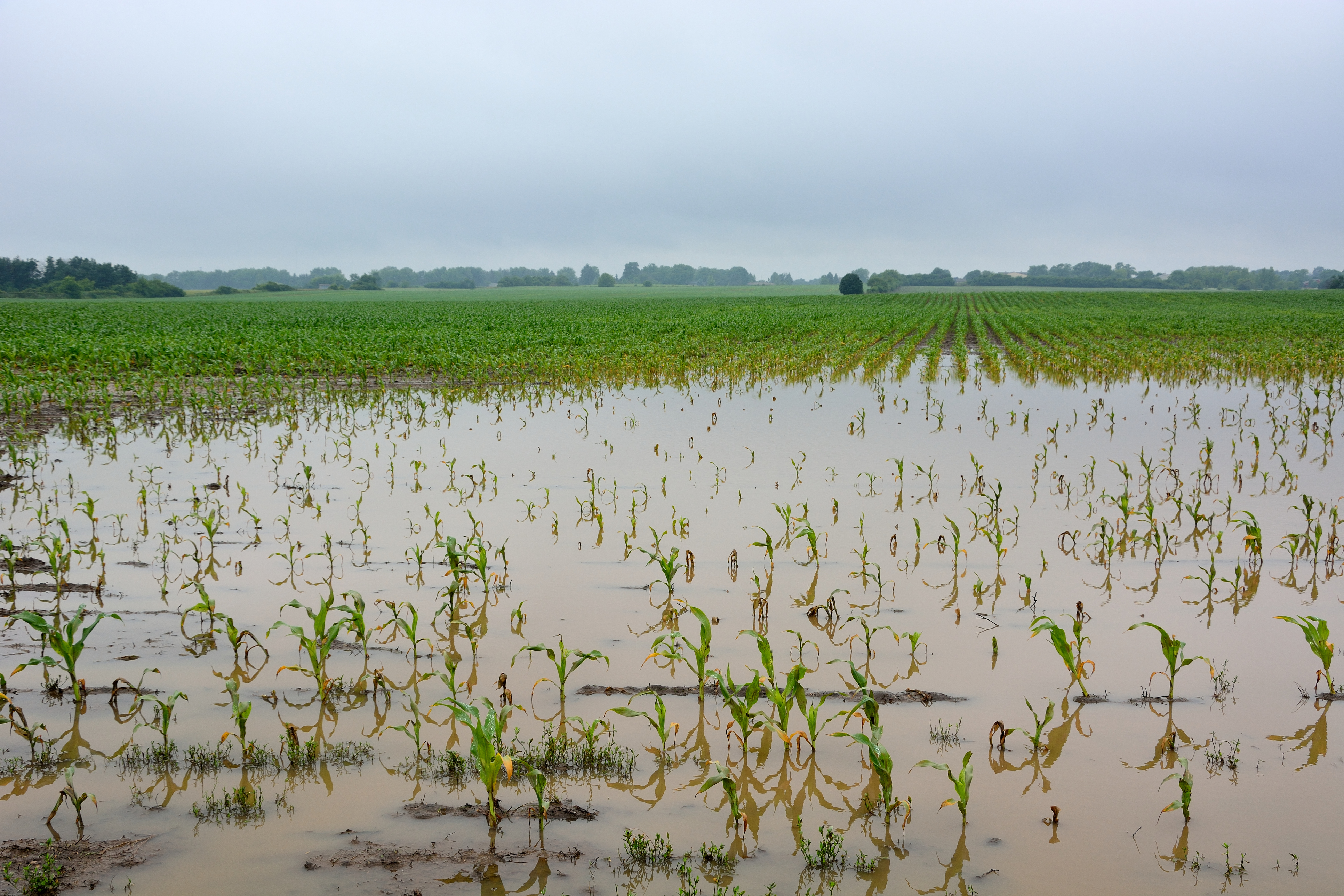
Let ‘s take the case of loss adjustment, where an insurance company needs to assess the percentage of crop loss caused by a specific weather event. Derived from a single or set of satellite observations, many different EO products could be generated, ranging from a simple NDVI to identifying crop growth zones and ultimately estimating the percentage of crop damage affected.
But how do we know which data serves an agro-insurance company the best? A factor greatly influencing this choice is the trade-off between the ease of interpretation and product uncertainty. In the case of loss adjustment, the current operational EO capabilities are not yet advanced to the point that they can identify sufficiently accurate specific crop damages, making it hard to decide purely based on EO data whether the observed damage is an insured risk or not. But that doesn’t mean that EO data can’t be of great value for the industry. Lower level products such as a regional benchmarking based on vegetation indices, or maps of within field variability are excellent indicators of potentially affected areas. It is acknowledged by the agro-insurance industry that these are well suited for planning logistics and support loss adjustment.
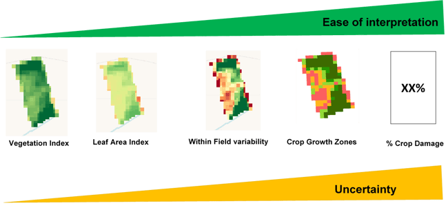
A range of Sentinel 2 based EO products relevant for crop damage mapping. Basic EO products can be converted into hands-on information, but it comes at a cost of uncertainty of the information. For each specific application, the ideal balance between requirements on accuracy and ease of interpretation should be assessed.
Bringing together the agro-insurance and EO industry
Despite the huge potential we also have to recognize that there is to date no off-the-shelf solution based on EO data that can accurately detect a wide spectra of separately insured risks. EO data can however have a strong contributing role. It is exactly for this reason that ESA initiated the ESA Earth Observation Best Practice for Agro-Insurance (EO4I) project. EO4I brings together the Agro-Insurance and EO industry sector to see how we can maximally exploit the use of EO products and services.
Within EO4I, we are working together with Geoville supported by the consultancy company AgroInsurance International, three insurance companies (Vereinigte Hagel, Swiss Hail & Austrian Hail) and two reinsurance companies (MunichRe and SwissRe).
Together with Vereinigte Hagel we are, for example, working on a case study to support their loss adjusters with EO data. More specifically, their interest is to explore satellite based maps that indicate the variability within a parcel of drought affected parcels to optimize loss adjustment. By using WatchITgrow, VITO’s online platform for digital crop monitoring, we are discussing which existing functionalities are relevant for their needs and what should be added to maximally exploit the data towards the agro-insurance industry. One of the requirements is combining different products and data sources. To evaluate for example a satellite based image of within field variability, you also need to know how the product reacted in previous growing seasons on different crop types. Offering and combining different types of data such as crop type layers, available meteo and soil data greatly benefits the interpretation of the EO data, allowing planning managers and loss adjusters to make better supported decisions.
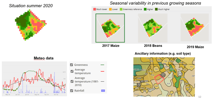
Example how WatchItGrow combines various sources of information to support the interpretation of EO derived maps.
Preparing for future capabilities
Looking ahead at emerging technologies, new missions and continuous R&D in the EO sector, it is safe to say that the EO capabilities will continue to increase significantly in the years to come. Dedicated collaborations such as EO4I are important to profit from available technology and develop innovative solutions.
Technologies like deep learning are a big help for yield estimation and crop damage detection, but will only work if there is enough training data. Agro-insurance companies are in principle well placed to collect such information, but should re-organize themselves to collect spatially explicit crop damage information. Data fusion methodologies that ensure a continuous monitoring of crop parcels (such as Cropsar) are very important for agro-insurance companies. Co-design activities allow us to move towards the full potential of the Sentinels to detect insured risks such as winter lodging, drought damage and hail damage. New sensors such as the LSTM missions that could detect plant stress in early stages, could enable the insurer to plan what losses can be expected before real damage occurs.
EO based crop damage detection could greatly benefit from spatially explicit in-situ collected information. WatchITgrow offers functionalities that have the potential to do so but it requires a reorganization of how agro-insurance companies typically operate which is not always trivial. There is a need for inter-sector discussions how to organize this type of in-situ data collection at larger scales.


/Blog_WorldCereal_1200x650.png)
/lewis-latham-0huRqQjz81A-unsplash.jpg)
/background_image_blog.jpg)