Supporting our scientific community
Financed by BELSPO’s STEREO programme, BELAIR supports the Belgian and international research community by enabling the development and exploitation of sustainable Belgian test sites and providing a wealth of data for EO research including in-situ, drone, airborne and spaceborne data. This data is linked to different projects e.g. for calibration and validation purposes for new EO missions or for generating new products.
What started in 2013 with a first “pilot” campaign has now turned into a network of researchers collaborating on the BELAIR test sites maximizing the use and exchange of instruments and data for different research projects. Together with more than 20 organizations we have collected multiple types of in-situ data, drone, APEX and satellite data over a limited number of BELAIR sites that are representative to cover a wide range of thematic areas crucial for many Earth observation projects:
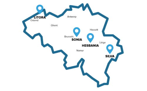
- BELAIR LITORA site
for coastal and biodiversity monitoring (Ijzermonding, Laege Moere and Zwin) - BELAIR SONIA site
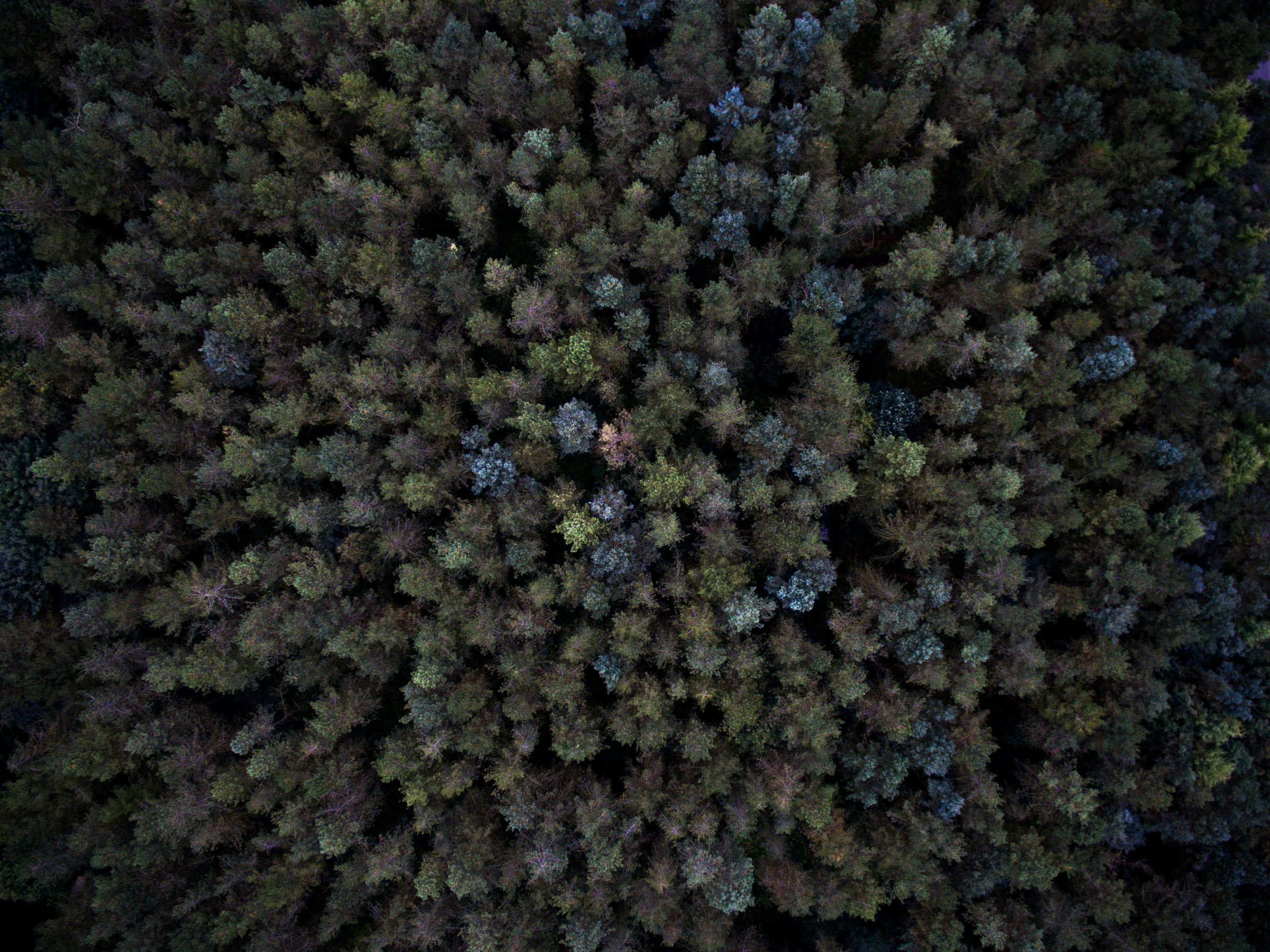
for urban and forestry (Brussels capital region) - BELAIR HESBANIA site
for agriculture and horticulture (lime belt between Sint-Truiden and Gembloux covering the ICOS Lonzée EU Research Infrastructure site) - BELAIR SILVA site
for forestry and vegetation monitoring (Liège, Vielsalm and Eupe, active since 2017, covering an ICOS Vielsalm EU Research Infrastructure site)
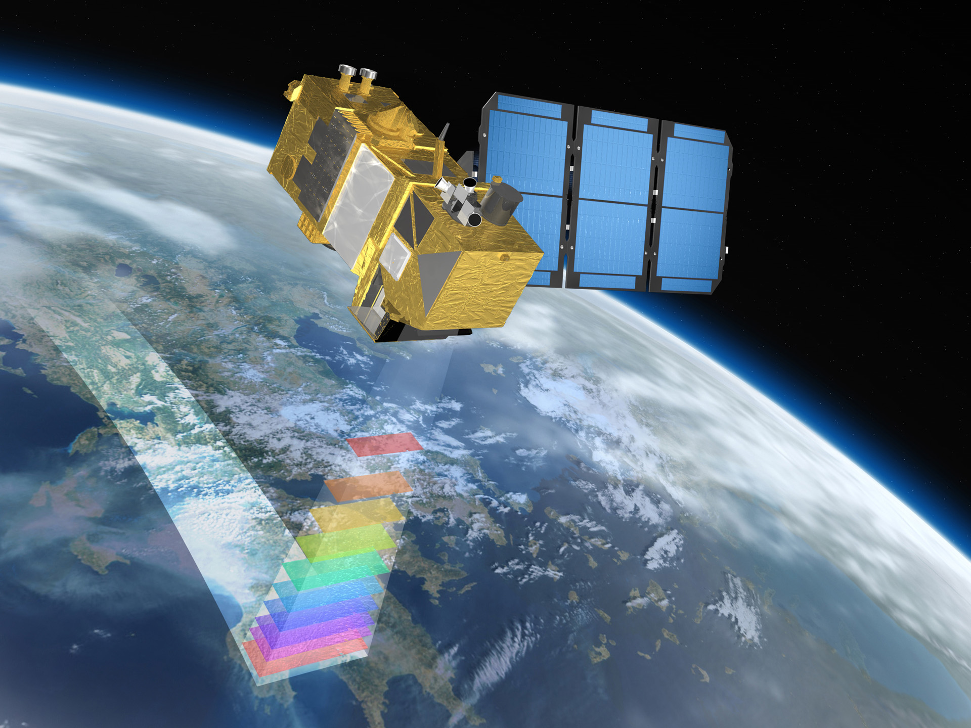
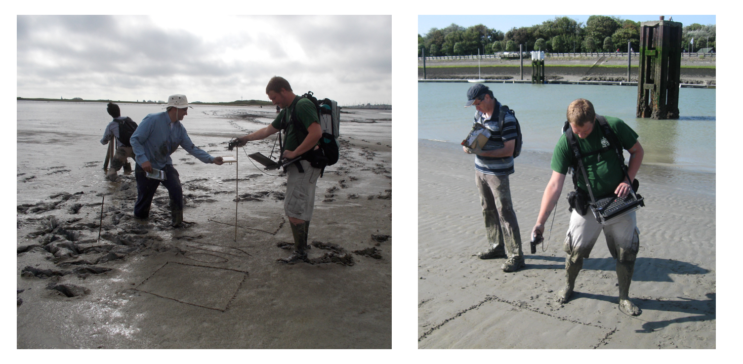
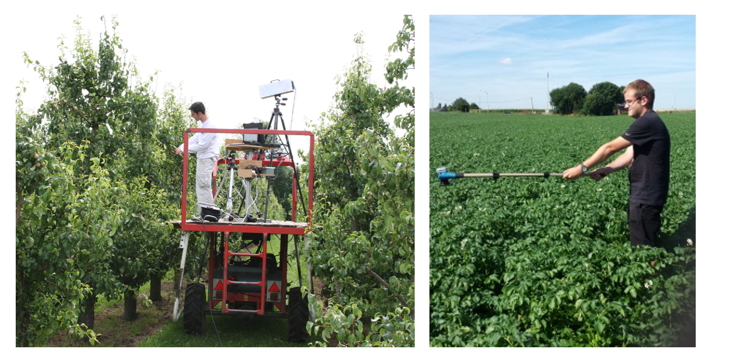
The instruments pool covers most possible requirements on spatial and radiometric resolution and on coverage. Collected data derived from in-situ measurements or from instruments onboard airborne or satellite carriers can differ from site to site and year to year. It ranges from field spectroradiometers that are used on the ground to ultra-light sensors onboard drones to scan e.g. orchards, a nature reserve or a forests. Also the APEX sensor captured multiple hyperspectral images of all BELAIR sites and different satellite images are available at request. All this data can be interconnected and are openly available after the campaigns.
A wealth of data already available
Now, in 2020, we look back at 3 main campaigns. We started in 2013, organized a second main campaign in 2015 and had our most recent one in 2017-2018. Our 2017-2018 campaign involved about 20 research groups and resulted in an extended data set which is made available through our BELAIR Geoportal.
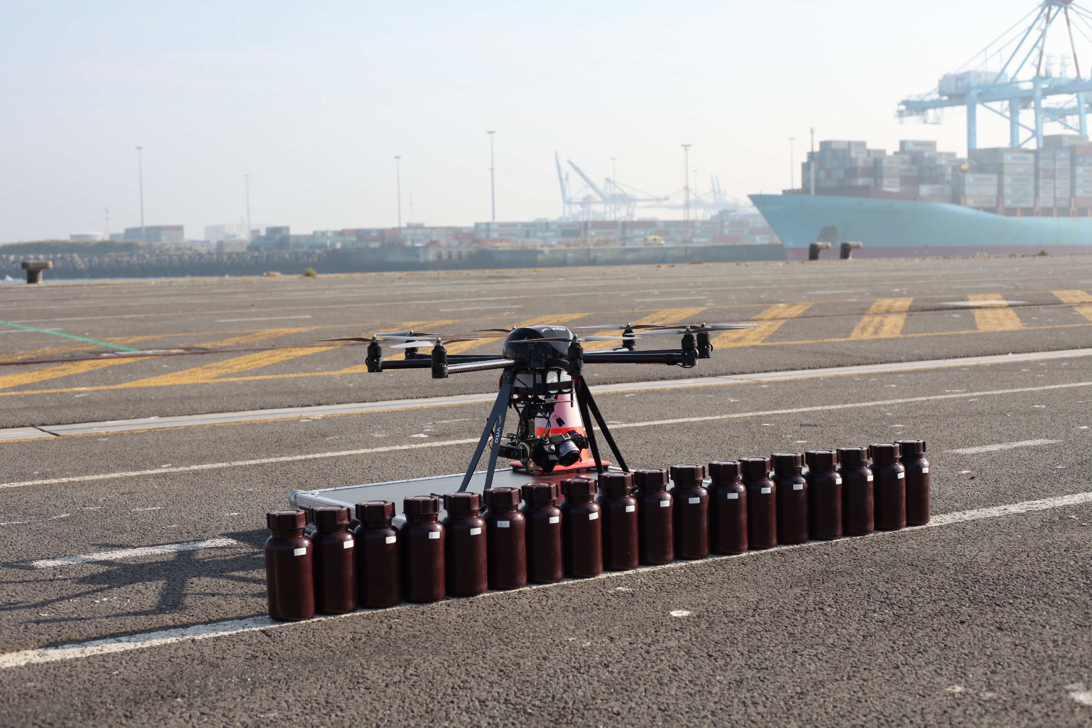
- 72 drone flights were performed over the different test sites
- 41 APEX flight lines spread over the different test sites
- Multiple in situ measurement campaigns resulted in e.g.
- ASD field spectroradiometer measurements from soil, leaves and other
- Information on grassland phases, dominant species and biomass samples
- Thermal Ground Sensor data
- Different pear and apples harvest data
- Information on flower clusters or buds from apple trees
- Fruit and stem diameter data
- Tree heights and diameter (DBH) information
- Photosynthetic active radiation measurements
- Laser-induced remote fluorescence measurements
- Soil moisture information
To increase accessibility and use of these data and related information we developed our BELAIR website and the BELAIR Geoportal, both accessible at https://belair.vito.be
A use case in monitoring fruit orchards
Each subsite has its own story in its specific application on what they did and the results achieved. Let’s have a closer look at the 2017-2018 drone campaigns on the HESBANIA site organized to gather information about the productivity and health of fruit trees. The HESBANIA team organized among other things a large drone campaign in the HESBANIA site. The fruit orchards were intensively monitored during the growing season (May – October) by in-situ monitoring and monthly drone flights (RGB, multispectral and hyperspectral) to get a complete overview of the growing season of the fruit trees.
Yasmin Vanbrabant, PhD student at KULeuven and VITO, has put a lot effort in acquiring all necessary information from the BELAIR Hesbania site: “To get a complete overview of the productivity and health of fruit trees during an entire growing season, we performed several drone flights combined with intensive field work. Throughout the season, we collected different types of ground data like : hyperspectral leaf measurements, pigment data, tree height and shoot length, yield quality and quantity data on tree level. A first result was a new multitemporal model to map the chlorophyll content of pome fruit orchards with the use of multispectral and hyperspectral drone imagery. Together with colleagues from PcFruit, KU Leuven and VITO, I published these results in a paper ‘Multitemporal Chlorophyll Mapping in Pome Fruit Orchards from Remotely Piloted Aircraft Systems’. But that’s not all. The data were also used in several new projects as well as student theses to e.g. investigate the use of airborne and drone data in fruit cultivation. In 2018 one of my thesis students also used the data to explored the potential of drone imagery to estimate vegetative growth and predict yield in apple orchards. Other students used senescence data of drone flights to evaluate influences on leaf discoloration.”
What does the future hold
Looking back to the previous campaigns our research teams involved can now rely on a well-established setup and collaboration for remote sensing campaigns in Belgium. The test sites are documented with an online archive and the continuity to support different research projects is feasible when new campaigns will be set up based on the user requirements and the previous experiences.
Concentrating data acquisition and resources on the four BELAIR sites and providing Open Access to FAIR (Findable, Accessible, Interoperable, Re-usable) BELAIR data via the BELAIR Geoportal allow researchers in Belgium and abroad to exploit the joint use of in-situ data, drone, airborne and satellite images to its maximum extent in order to optimally support EO missions and research.
Ils Reusen - Project Manager, VITO Remote Sensing
To inquire the needs of our research community an online survey will be organized in which partners can give feedback on previous campaigns and express their future demands. We look forward to receive this input, because as Lord Kelvin quoted “If you can not measure it, you can not improve".