Ground control points, a necessary evil?
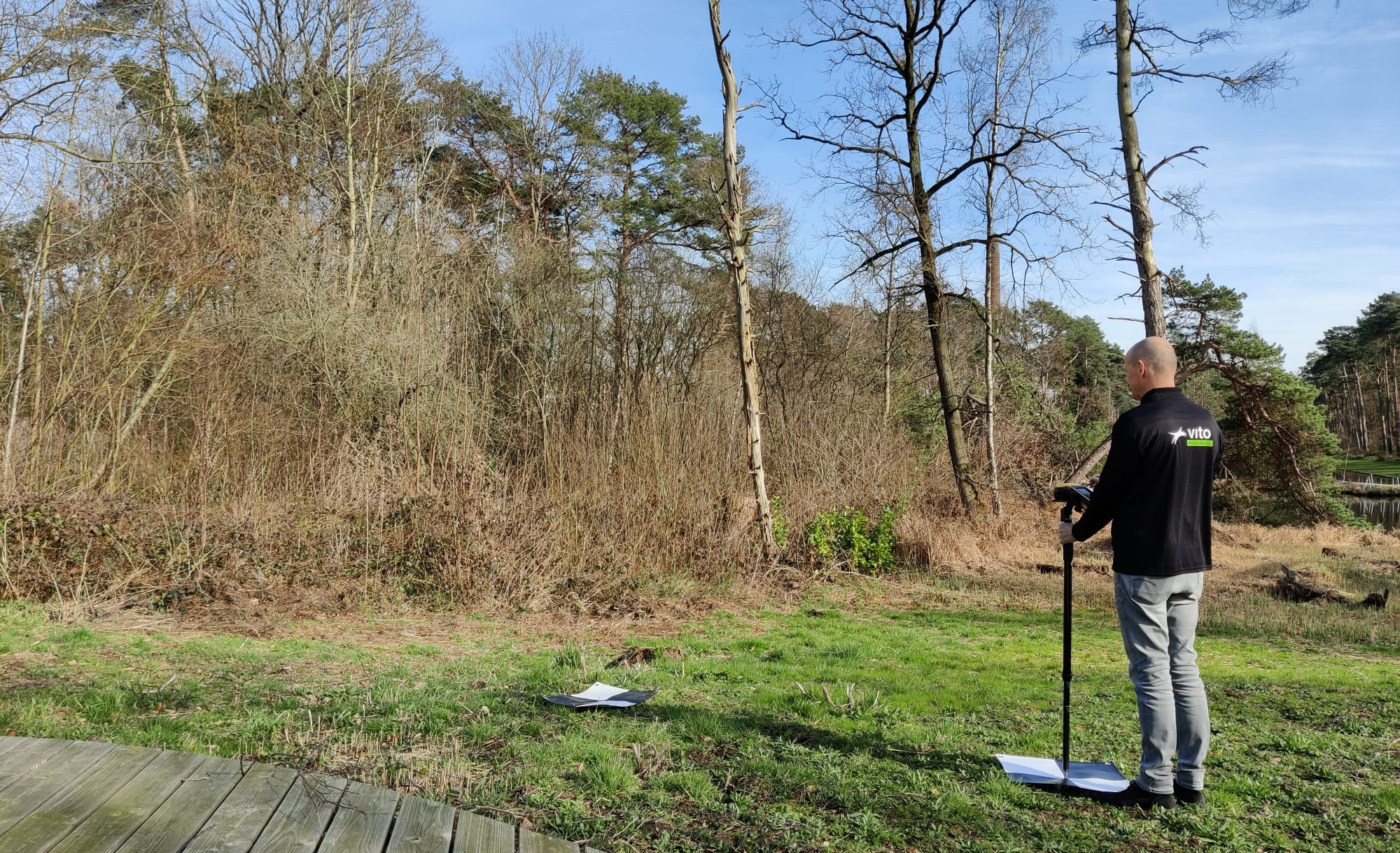
Imagine you just bought the latest, most advanced drone including highly accurate RTK navigation and geotagging which makes your drone flights pass by like a breeze, no matter what the conditions. No matter how high-tech or equipped, there is still a high chance that you’ll need to drag along 10€ GCP panels around the field. When you need accurate and consistent data, you cannot avoid using ground control points.
Drones of course also use GPS and other sensors to determine their location and orientation in space. However, these measurements can be imprecise due to poor reception/quality of GPS or RTK correction data. This can result in errors and inaccuracies in the final map or model. By using ground control points, which are physical markers placed on the ground with known geographic coordinates, the drone's measurements can be corrected and validated at any time. This helps to eliminate or minimize errors and improves the accuracy and consistency of the resulting map or model.
So, GCPs are indispensable but they also complicate your drone mission, increasing the overall time and cost you spend on a project.
- The GCPs must be placed in locations that are visible from the drone’s perspective which can be challenging in complex terrains (e.g., dense vegetation)
- They need to be accurately measured and marked with their geographic coordinates which requires some expertise and specific equipment
- GCPs need to be integrated smoothly in the image processing solution
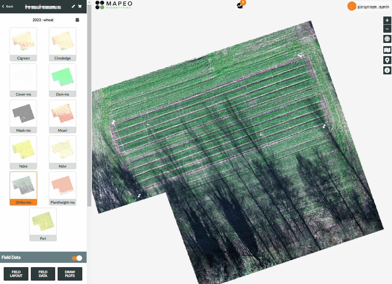
Easily spot and check your ground control points (GCPs) in MAPEO
Five tips to boost your GCP handling
If you are new to the field of drone mapping applications, GCPs can be quite confusing and a mistake can be easily made. Here are five tips which will boost your GCP handling and drone map accuracies for the upcoming drone season.
- Place sufficient GCPs in the field:
A good start is half the battle. A nice saying when managing drone (flight/acquisition) campaigns. One of the most commonly made mistakes is to not use enough GCPs in the field. You should use at least 6 GCP’s for a non-RTK flight and 2 GCPs for an RTK-flight. One of these GCPs can then be used to validate the quality of your drone products, as trust is good, but verification is better.
If the region of interest you want to fly is not a nice rectangular field, we advise to place more GCPs so every corner in the field is covered. - Check permanent GCPs:
If you leave the GCPs in the field for days or even months because you are flying regular flights of the same area, then it is a good practice to first check all GCPs and make sure they are still visible and e.g., not covered by dirt or vegetation. If they are covered your GCPs will be useless, so make sure to check and clean them when needed.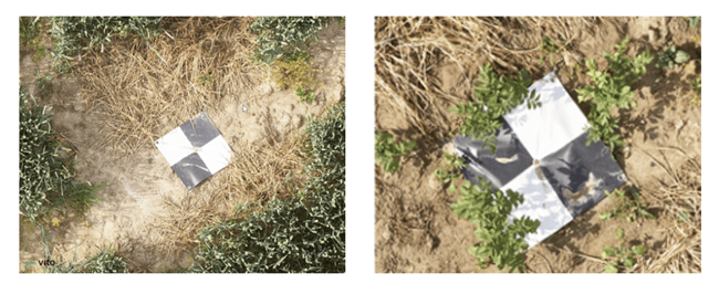
- Use the right coordinate system:
In order to be able to process your images correctly, make sure you provide the GCPs with the correct coordinate system. Preferably you should use a frequently used system, like WGS84 (EPSG:4326), and not a country specific coordinate system. - Check the quality of your GCP coordinates:
When measuring the GCPs you should pay attention that the precision of the measurements is good (cm-level accuracy), and you operate the equipment as described in the manual. If your GCP measurements are not accurate enough it will not be possible to get a very accurate drone product either. If you are not sure about the quality indicator, you can measure a particular set of GCPs multiple times and verify the precision of the measurement on each point. - Avoid having GCPs too close to each other:
There should be enough space between the different GCPs, because if they are too close to each other it might be very confusing during the marking of the GCPs in the GCP-labelling step.
If for some reason you would like to put GCPs close to each other, make sure to mark or label your GCPs in the field so they can be easily identified afterwards during processing.
Easy solutions for GCP handling in MAPEO
Easy solutions for complex problems. That is also what we try to bring to the users of our MAPEO platform. MAPEO now also provides features to make GCP handling smoother and more efficient.
- Operational procedures to support the use of GCPs:
It all starts with good practical knowledge about the placement and measurements of the GCPs. The MAPEO knowledge center provides several operational procedures which you can consult if you need more information on how to install or measure your GCPs. - Upload and visualize GCP coordinates:
You can easily upload the GCP coordinates to MAPEO. Via the site information you can directly see the GCP icons on the map and adapt the coordinate system if needed.
You can also edit the location boundaries when you e.g., need to match the field boundaries to the GCPs. - Direct communication with the pilot:
MAPEO automatically makes the GCP and boundary information available to the pilot via their field software account once the location (flight area) is finalized. This avoids miscommunication and speeds up the process as the pilot can immediately start planning their first flight(s).
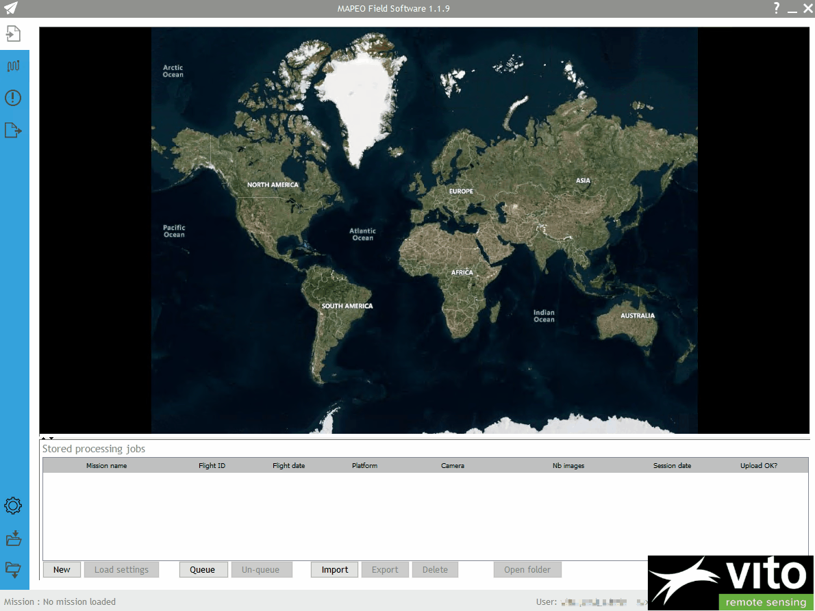
A view of the MAPEO field software which allows you to immediately check the data and spot potential issues.
- Immediate data quality check:
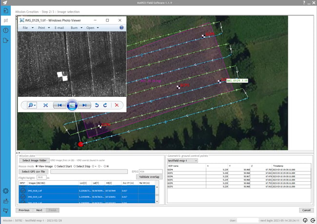
After the first drone flight, the pilot performs the quality checks in the field and assures data completeness and correctness before uploading to the processing software. By clicking on the drone images next to the GCPs, a pilot can directly spot potential issues.
In case the pilot flew with an RTK drone, the RTK signal – and its consistency along the flight – is analyzed and in case of problems the pilot is warned. Depending on the number of GCPs present in the field, the pilot can continue uploading the mission or must redo the flight and/or put some more GCPs in the field. - Speed up the GCP labelling:
The last step in the process is the GCP labelling in the images, based on which the drone map products are geolocated with an absolute accuracy of 2-3cm. For this labelling, the MAPEO operations team work with our very own GCP tool which has some unique features to speed up the GCP labelling and ensure quality and consistency. If there is something wrong with the geolocation accuracy, this is communicated back to customer and/or supplier.
A screenplay of how MAPEO can support you with your GCP handling
Keep in mind the tips in this blog and you’re all set to collect valuable and accurate drone data in an easy, smooth and professional way. Find out more about MAPEO applications and services in our related blog posts and the MAPEO website, and don’t forget those GCPs for your next drone mission!