Training & capacity building FOR pilots and growers
Together with the project partners, VITO has implemented an extensive training program aimed at instructing pilots and farmers/growers in the acquisition, analysis, and interpretation of drone data. Our objective was to provide employees with essential skills, spanning from fundamental principles to advanced applications.
To ensure optimal engagement of employees, pilot projects were executed in close cooperation with potato, strawberry and pear growers, along with drone pilots. The guidance process encompassed
- an initial visit to elucidate application goals and anticipated outcomes
- instruction on utilizing the MAPEO web application
- support for drone flight execution
- guidance and counsel on interpreting results, and
- feedback on protocols and improvements for subsequent campaigns.
For the fruit pilot initiatives involving strawberry and pear growers, pcfruit and VITO collaboratively authored a guide directing fruit growers on the necessary steps to request a drone flight through the EVA app. EVA is seamlessly connected to the MAPEO drone processing chain (VITO), ensuring that requests become immediately activated in MAPEO.
A similar guide, developed by ILVO and VITO, assists potato farmers and drone pilots in utilizing drone technology for Alternaria detection via MAPEO.
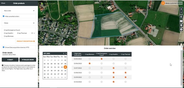
The MAPEO platform offers a simple module to order drone flights and products.
Interested pilots received extensive training on how to perform drone flights in agriculture, with optimized MAPEO field software and a detailed manual. A dedicated pilot training course, developed in collaboration with Syntrum, was incorporated into the list of available Syntrum courses. The pilot handbook is accessible on the MAPEO help center.
Our training initiatives empower drone operators to specialize and deliver high-quality data, offering valuable data insights tailored to the specific needs of growers. We expect that these drone operators will be approached again following the positive experience shared by growers within this project.
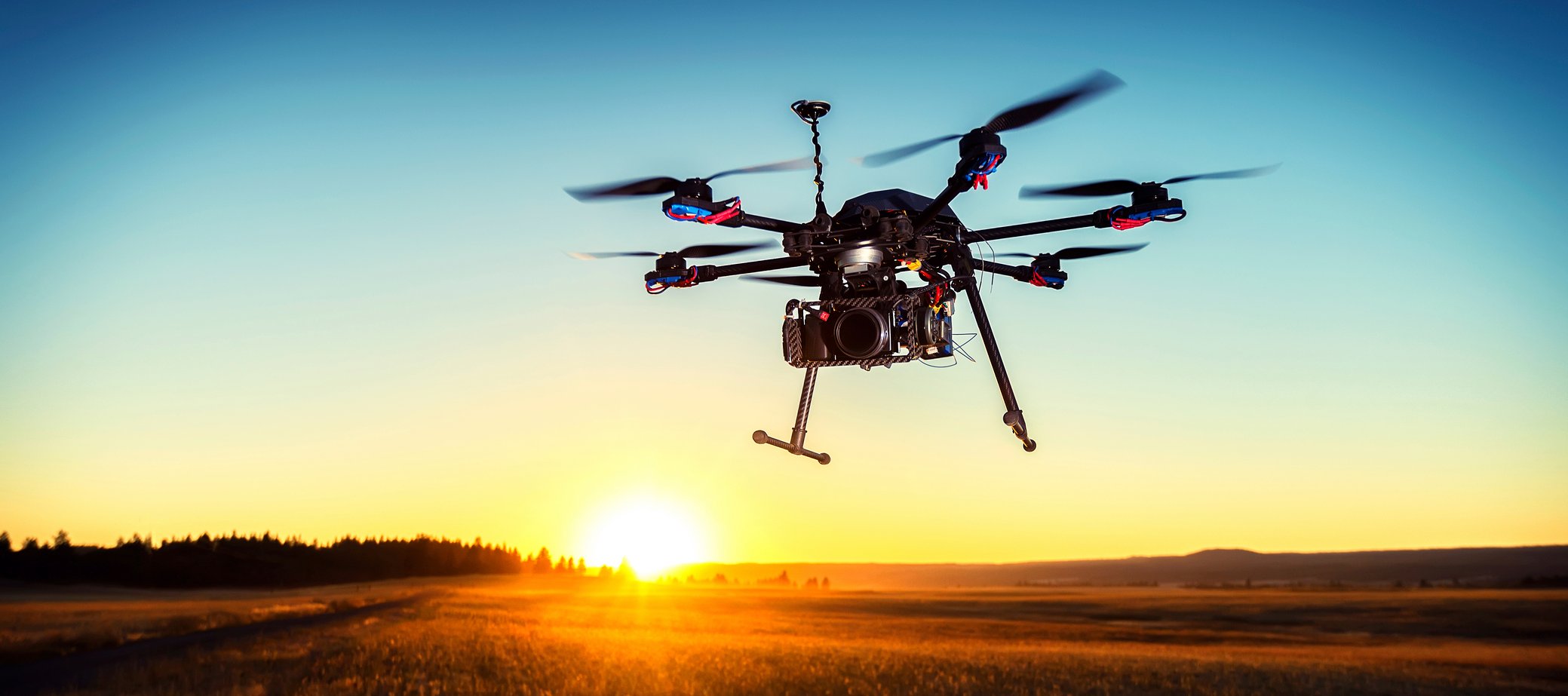
Innovative Technology integration
Cutting-edge drone platforms and sensors gathered diverse data, encompassing high-resolution multispectral and RGB images. The processing of these images involved the application of artificial intelligence techniques. To simplify the utilization of drone technologies for growers, MAPEO automates these algorithms, which are crafted by experts. Additional MAPEO functionalities were created to facilitate the accessibility of third-party results in the viewer, eliminating the necessity for farmers to possess advanced technological knowledge to extract value from their drone data.
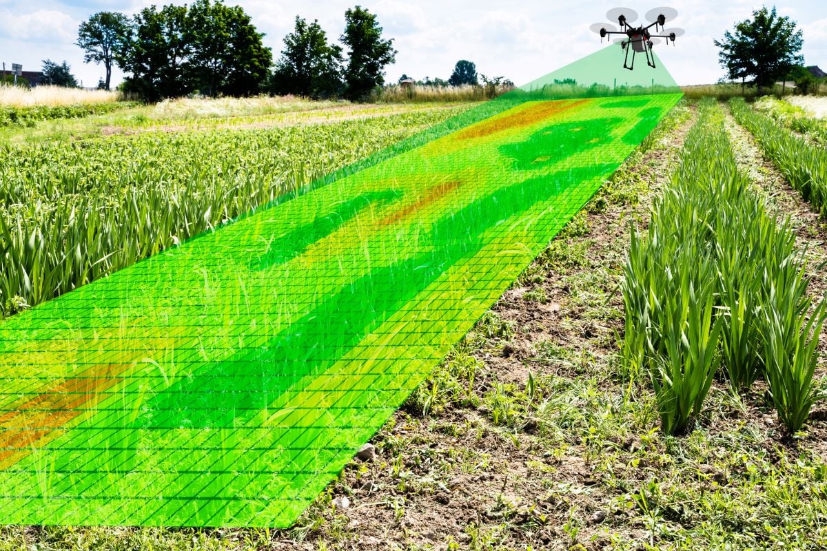 visualization of the results
Acknowleding farmers' keen interest in information and advice that directly enhances their business operations, the resulting maps are displayed in a user-friendly MAPEO web environment, easily accessible to growers. ILVO and pcfruit analyze these maps to offer guidance to potato, strawberry, or pear growers. To streamline the work of fruit growers, the resulting maps are also integrated into their familiar fruit management app, EVA.
Visualization of the drone imagery in the MAPEO platform: strawberry blossom count
PROmoting sustainable agriculture by reducing technological barriers
The objective of this guidance in specific pilot projects goes beyond enhancing efficiency and yield in agriculture. It also aims to lower the use of resources and to encourage environmentally friendly practices. Precision farming methods, facilitated by innovative digital technology, empower farmers to minimize inputs while maximizing yields. Eliminating the initial barrier to this by making innovative digital technology accessible represents a significant leap forward.
This ESF-funded project places emphasis on the human aspect alongside the technological narrative, offering practical guidance, insight, and trust to companies utilizing drone applications.
As drone technology continues to evolve, an increase in the adoption of drones in agriculture is anticipated, providing a positive outlook for both farmers and the industry. The guidance process is expected to play a crucial role in shaping the future of more sustainable agriculture.

/Blog%20Post%20Strip%20Cropping%20-%20Featured%20Image%201200x650%20150%20ppi.png)
/Blog_WorldCereal_1200x650.png)
/lewis-latham-0huRqQjz81A-unsplash.jpg)