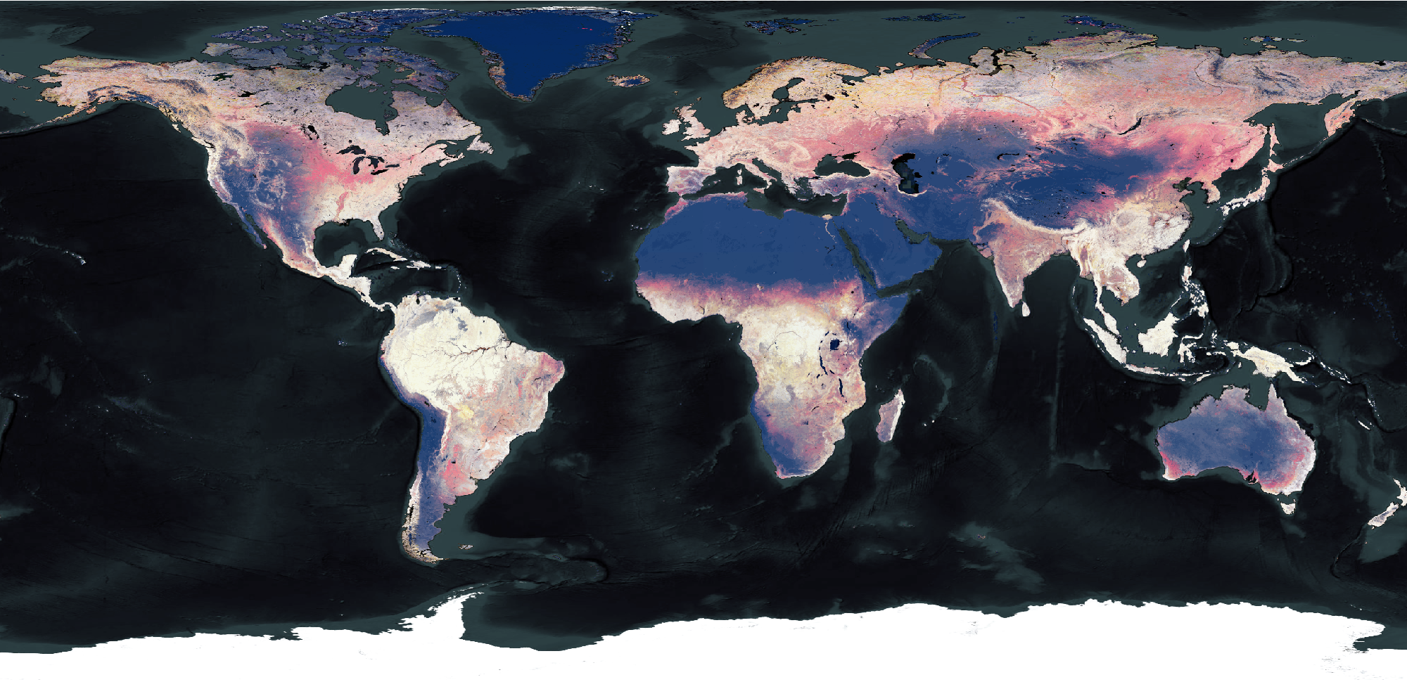
7 years of celebration with a cherry on the cake
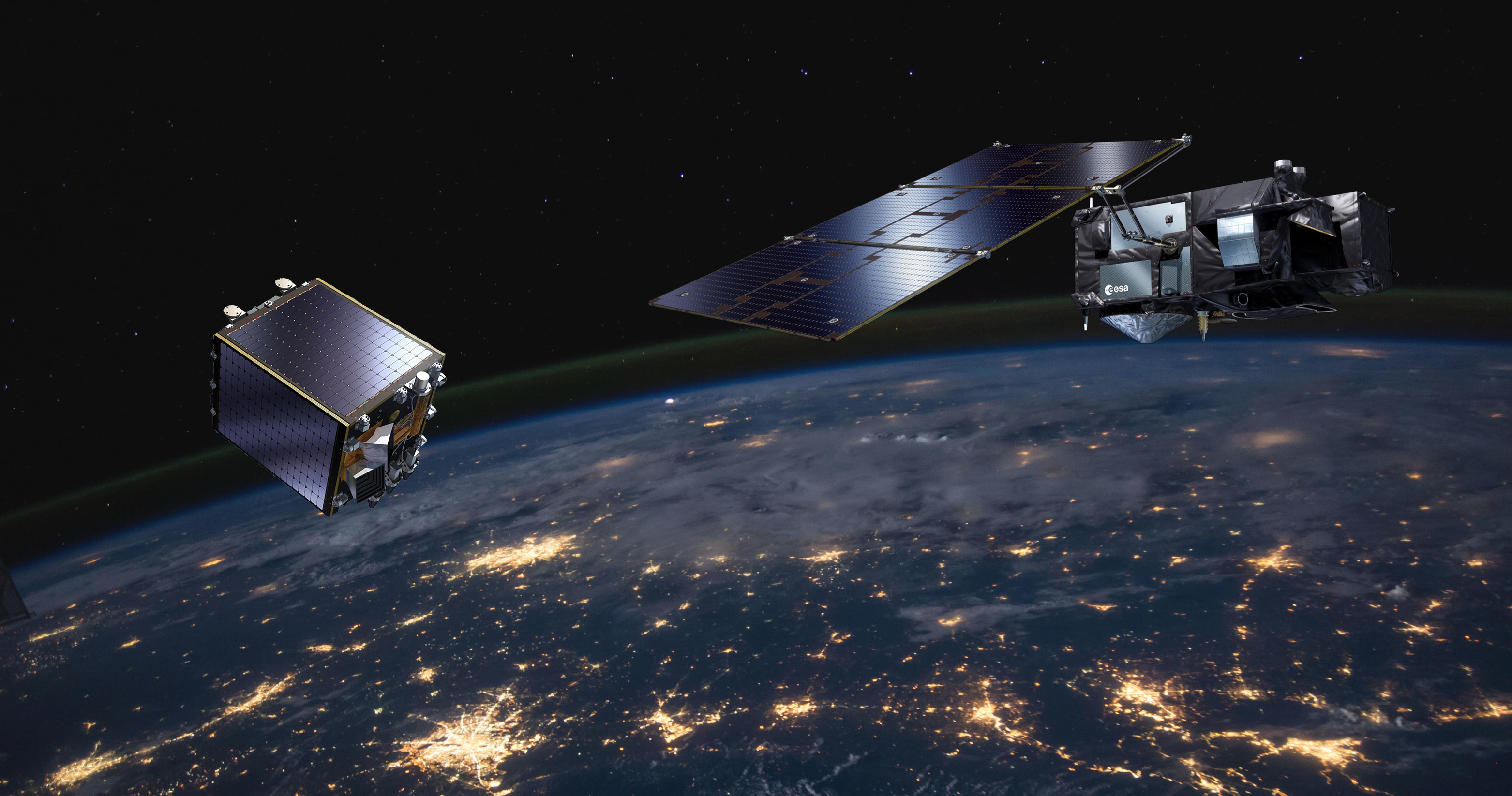
With its launch on May 7, 2013, we’ll soon hit the 7th birthday in space for PROBA-V. Thanks to the stable performance of PROBA-V, the operational mission was extended till June 30, 2020. A reason more to celebrate. This means all products in across the different resolutions will be acquired and generated to its full extent as we are doing on a daily basis for almost 7 years now.
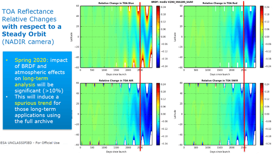
At the start of the mission, we knew that there would be an inevitable end to this as PROBA-V was one of the last European satellites that was launched without on-board propulsion, resulting in a decrease in satellite overpass time. This called ‘orbital drift’ also implies a consequential impact on the data quality which will further increase in the future making it impossible to keep within set requirements for the mission and delivering the same high-quality data. Luckily, our brave little satellite is still full of surprises.
Ensuring continuity for our end-users
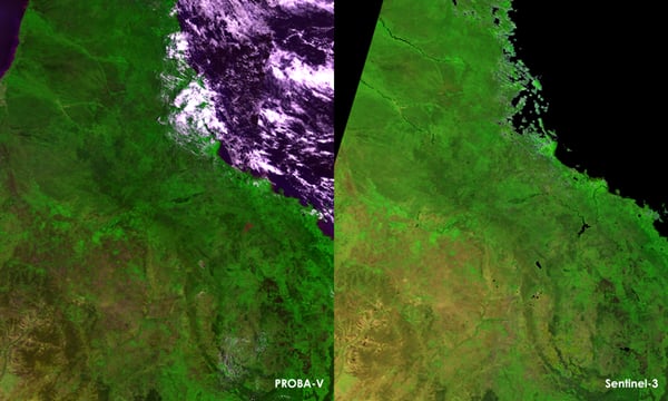
The mission's ultimate objective was to guarantee the continuity of the SPOT-VEGETATION time series and to bridge the gap towards Sentinel-3 data. So, what does the future hold for our global land cover community? There are a number of ongoing efforts to ensure continuity of end-user products, such as Top-of-Canopy reflectance (TOC) and Normalized Difference Vegetation Index (NDVI), by switching from PROBA-V to Sentinel-3:
-
The SYN branch of the ESA Sentinel-3 processing provides 1 km VEGETATION-like products: TOA reflectance (SY_2_VGP), 1 day synthesis surface reflectance and NDVI (SY_2_VG1) and 10 day synthesis surface reflectance and NDVI (SY_2_V10).
-
The Copernicus Global Land Service is also preparing the switch for the 300 m and 1 km NDVI. The processing line will include BRDF-correction to minimize the effect of differences in illumination and viewing angles.
We kindly ask our users to keep in mind that providing temporal consistency when switching from one sensor (PROBA-V) to another (Sentinel-3) is a challenge. The process is affected by many different factors, such as differences in radiometric calibration, differences in spectral bands, and differences in orbital characteristics and scanning systems. All teams involved strive to minimize the impact to users and downstream services.
More cherries to come
Despite the orbital drift, the radiometric and geometric performance of the satellite is still in very good condition and it would be a waste not to use these capabilities anymore. So, to top it all off, the decision has been taken to change the status of the mission to “experimental” from July 1, 2020 until October 30, 2021. What does this mean?
- Besides ensuring continuity with Sentinel-3 for the global products, PROBA-V will keep acquiring data over the European and African continent, still using its full swath.
From July 1, 2020 onwards, we will deliver level 3 products of Europe and Africa in 100 m, 300 m and 1 km resolutions - In close coordination with the members of the Quality Working Group, several scientific experiments will be investigated such as regular moon acquisitions for multi-mission calibration purposes and special actions over calibration areas.
- Radiometric and geometric quality will be assessed and maintained, but no guarantees will be given on data quality due to orbital drift.
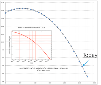 Current and predicted overpass time for PROBA-V. Note that overpass time Sentinel 3 is 9:30 (Source: F. Niro (ESA) – Mission Extension proposal and strategy – PROBA-V QWG #10)
Furthermore, another extension of the PROBA-V mission will be granted through the launch (projected from 2021 onwards) of some additional companion small satellites that will expand the capabilities of PROBA-V, in terms of repetition/sensing times and spectral content. The proposed companion small satellites will follow the above approach taken with PROBA-V and experimentally pave the way for new advanced vegetation monitoring applications, based on the fusion of imagery from identical sensors embarked on different platforms (mixed source), or even different sensors on different platforms (mixed content) into new high resolution (<= 100 m) products.
Serving a large scale community
As PROBA-V will remain a valuable data source in many end-user product, including several products of the Copernicus Global Land Service, the entire PROBA-V archive will remain available, open and free for anyone to use after the operational mission lifetime, including all Mission Exploitation Platform functionalities.
To guarantee a user-friendly data access for the upcoming years, the distribution platform will be upgraded in the coming months and the entire archive (collection 2) will be reprocessed.
An overview of some important upgrades still to come to serve our user communities.
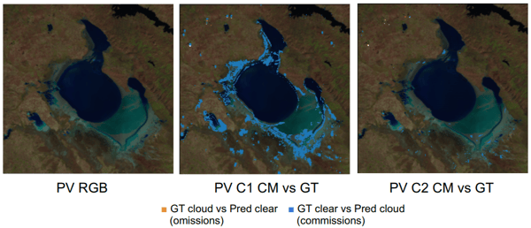
- Collection 2 data will be improved in terms of cloud masking, atmospheric correction and radiometry. The new collection will be released first half of 2021.
- The entire portfolio of applications and services that were built in the PROBA-V Mission Exploitation Platform will be maintained for the foreseeable future and make sure you have every full, free and open access in every sense towards the entire collection.
- The product distribution front-end will receive a major user interface update
- The MEP will be expanded for on-boarding user-based services into ESA’s Network of Resources
- PROBA-V’s datasets and ways to access the data will be embedded into Belgian’s Collaborative Ground Segment, better known as Terrascope.
Current Comparison of new cloud mask methodology (C2, right) to current cloud mask (C1, middle) for Lake TUZ, Turkey (Source: Luis Gómez Chova, Gonzalo Mateo García, Dan López Puigdollers, PROBA-V C2 Cloud mask, QWG #10)
What an incredible team
Last but definitely not least we would like to thank BELSPO and ESA for the continued support and vision for all the Vegetation programmes, which led to an unique daily global pulse of the planet. This is and has been an incredible journey with widespread impact on the world.
Do you want to stay informed about the upcoming changes, upgrades and experimental actions still to come, subscribe to our PROBA-V newsletter.
Any questions? Don’t hesitate to contact our user and scientific helpdesk or keep an eye on our website and Twitter account as we’ve got some things to share.


