Why is EO calibration vital?
Although satellite missions undergo comprehensive pre-launch calibration in dedicated test facilities, variations in the characteristics of the sensors are likely to occur in orbit due to impact of the launch, aging of the optical parts, thermoelastic deformations and cosmic ray damage. This makes it necessary to perform in-orbit stability monitoring and calibration. Large-scale missions are often equipped with onboard calibration devices. However these onboard calibrators do not allow for cross-calibration between missions, furthermore, they may themselves suffer from degradation in the outer space environment. Small satellite missions, on the other hand, usually lack onboard devices due to constraints on size, weight and power consumption. This means that vicarious calibration, which makes use of natural targets on the Earth and/or lunar calibration, must be in place to calibrate the Small Satellite missions, to verify the calibration of the instruments onboard large missions and to inter-calibrate between missions, including historical missions, for the generation of for instance long-term reliable climate data records.
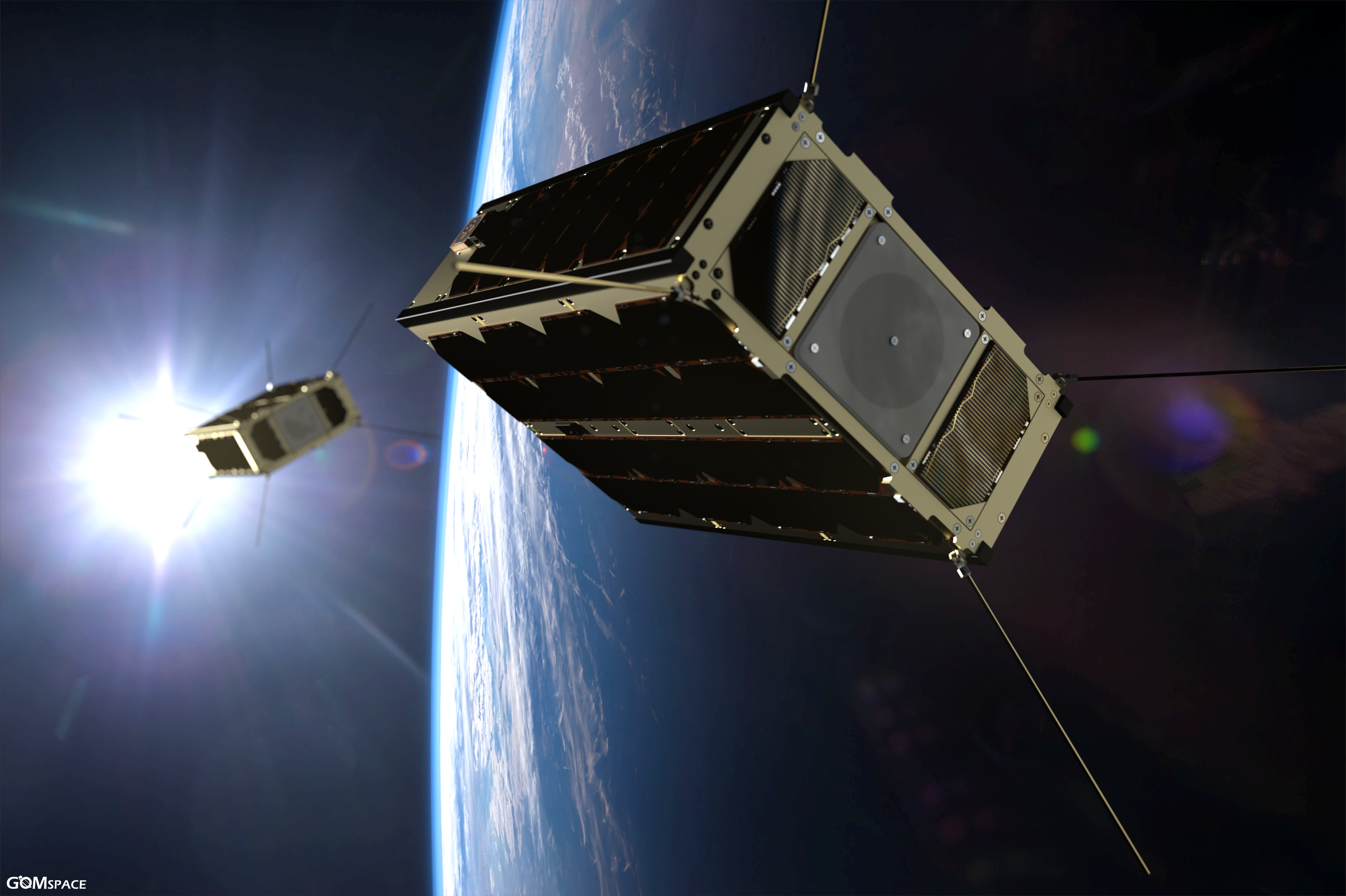
When we use CubeSats for EO purposes, we also have to keep in mind their geometric instability. Environmental monitoring and land cover management applications (e.g change detection) require a high geometric quality (subpixel accuracy). These applications usually analyze dynamic phenomena which cause changes on the Earth surface. The scene dynamics are identified by using change detection techniques to automatically label changes occurring between images of the old state of a scene and images of its current state. Relative instability in the geo‐location of on‐ground pixels may impact drastically the performance of change detection techniques limiting their capability in detecting substantial and real changes. Improving the geolocation accuracy on the one hand by enhancing the onboard geo‐pointing and on the other hand by developing robust on‐ground image-based techniques, is therefore a prerequisite for offering reliable and affordable products from space.
VITO rEMOTE SENSING calibration expertise
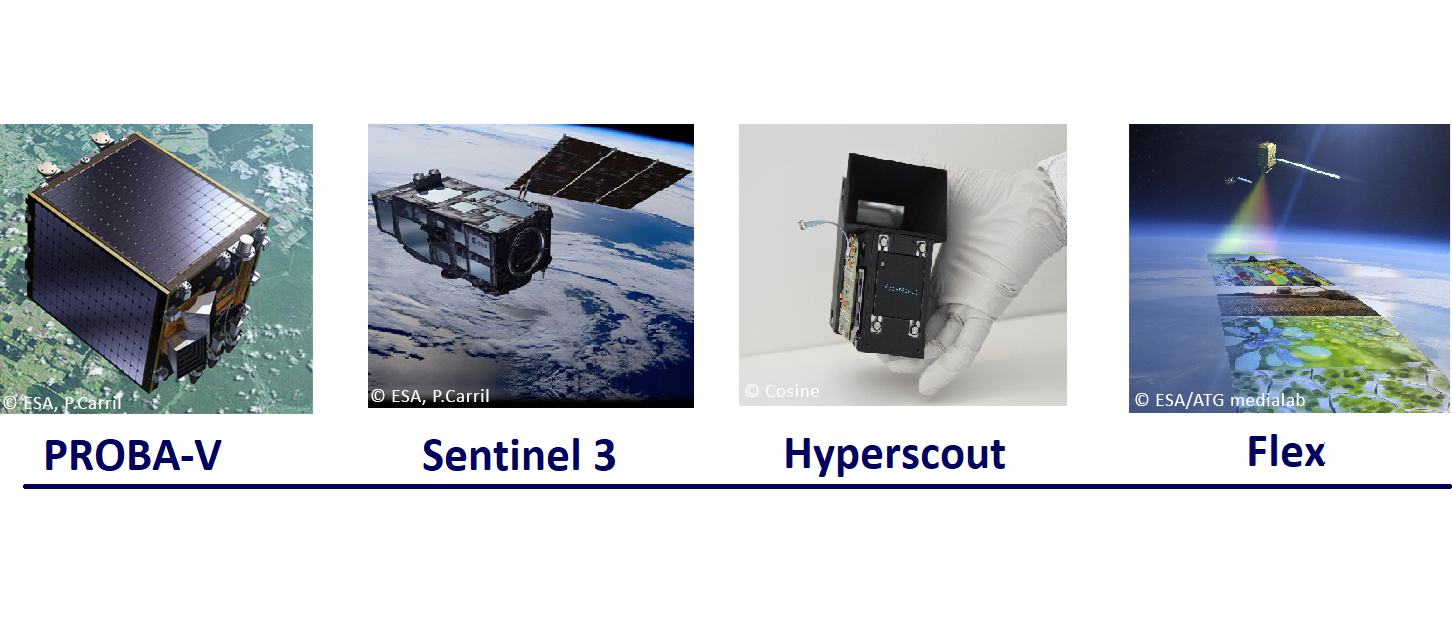
Our Calibration & Validation team has built up some significant proven expertise in the field of in-orbit calibration. For instance, we developed a fully in-orbit operational vicarious calibration facility for ESA's PROBA-V satellite mission. The CAL/VAL facility monitors the radiometric/geometric precision and stability over time and derives correction parameters to ensure a high-quality end product. VITO Remote Sensing is also contributing to other current and future EO missions. As an Expert Support Laboratory (ESL), we provide expert analyses to the ESA Sentinel-3 Mission Performance Center on the verification of the OLCI L1 radiometry and defined the vicarious, lunar and spectral calibration algorithms for the Earth Explorer Fluorescence Explorer (FLEX) mission. Recently, we also successfully accomplished the HyperScout validation campaign of the processing algorithms (Level 1 to Level 2A) and the execution of the in-orbit vicarious calibration allowing the delivery of improved geometric and radiometric final products.
Last but not least, VITO Remote Sensing is a key player in lunar calibration in Europe. Besides operationally using lunar calibration, we scientifically contribute, to extend and to improve the lunar irradiance model, targeting sub 2% absolute radiometric accuracy, in the frame of a dedicated ESA project.
USECASE 'HYPERSCOUT':
A Challenging calibration process
HyperScout is an innovative CubeSat mission, developed by Cosine and the consortium partners S&T Norway, TUDelft and VITO Remote Sensing, which captures hyperspectral imagery with 70m GSD. Obtaining good radiometry for such a mission is a challenging task because the amount of acquisitions is very limited, while at the same time every line of the sensor has a different spectral response and thus needs to be calibrated separately. This is due to the Linear Variable Filter Imaging concept as explained in one of our previous blogs: 'Hyperspectral imaging reinvented'. The challenge for the innovative imaging concept lies in the accurate recombination of the all individual images into the final hyperspectral data product. To reach this goal a good image processing flow and calibration step is required.
We applied an innovative geometric calibration strategy to calibrate the HyperScout raw imagery. State of the art geometric calibration was used (Structure from Motion (SfM), photogrammetric algorithms combined with a rigorous geometric modelling). The initial geometric assessment showed a gradual geometric shift between successive frame acquisitions. The longer the frame acquisitions are separated in time, the larger this shift is. The geometric calibration approach allowed to identify and remove the observed relative and absolute geometric bias and enhanced the characterization of the line of sight distortion over the entire field of view using the full frame acquisition mode.


Figure 1: Projected HyperScout frame images showing the relative geometric distortion between successive frames (before calibration (left) and after calibration (right). Please notice that after calibration, the acquired area is not shifting from one frame acquisition to another.
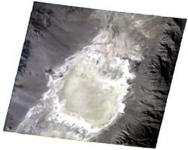
We established good radiometric quality by performing vicarious calibration based on an acquisition over a stable desert site, and showed an absolute accuracy within 5%. The line-based calibration approach resulted in improved results on the final image products.

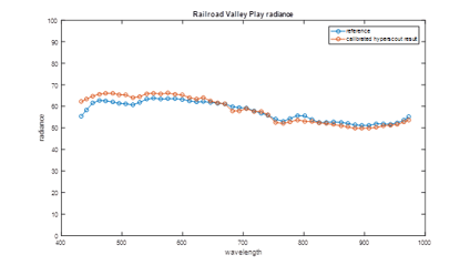
Figure 2: Vicarious Calibration based on Lybia 4 reference site applied to Railroad Valley site (left) and resulting average spectral radiance from Hyperscout compared to modeled reference (right).
After a successful calibration, the correction parameters were used in the processing facility and the final spectral hypercube products were generated over several Region of Interest.
TOWard a sustainable cal/val expertise
VITO Remote Sensing has demonstrated expertise in the field of vicarious calibration and data quality validation. It allows to enhance the data quality of future CubeSat and small sat missions. Below several data products are shown, processed by Vito from the HyperScout raw data.
If you have a though calibration nut to crack, do not hesitate to contact us.
We are in for a challenge!
Left: HyperScout RGB scene acquired over Cylanpinar (Turkey) on the 31/10/2018.
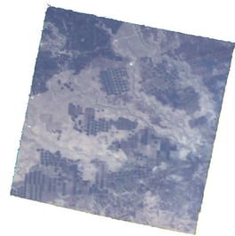
Right: HyperScout RGB scene acquired over Railroad Valley (US) on the 7/11/2018.

/CalibrEO%20Service%20Header.jpg)