CalibrEO: Precision in Calibration and Validation
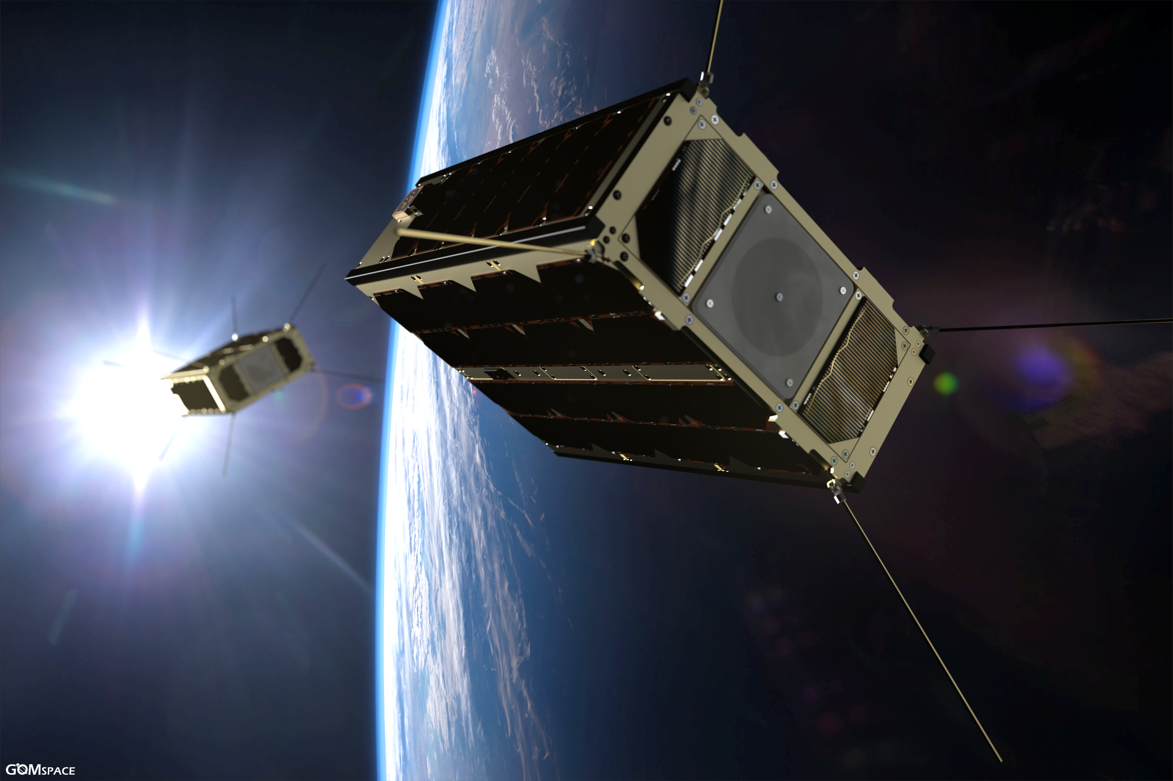
In the fast-evolving world of satellite Earth Observation, ensuring that data is accurate, consistent, and analysis-ready is no longer optional—it's mission-critical. CalibrEO, developed by VITO, is a state-of-the-art in-flight radiometric and geometric calibration and validation service, designed specifically to enhance the quality and reliability of data from Small Satellite (SmallSat) missions—whether it's a single satellite or a full constellation.
CalibrEO improves mission performance by delivering accurate calibration parameters, image quality assessments, and long-term monitoring—all tailored to your sensor system and operational needs and constraints. The service supports both line array and frame sensors. CalibrEO provides three levels of calibration services at competitive rates, allowing you to select the scope and depth of service that best suits your mission and budget.
A key strength of CalibrEO lies in the clarity and usefulness of its deliverables. Clients receive a comprehensive calibration report detailing scientific methods, results, quality indicators, and actionable insights—presented in a clear, concise and mission-supportive format. Explore our sample calibration report to discover what you actually receive.
By ensuring that your satellite data is scientifically sound and ready for your application, CalibrEO provides a strong foundation for any Earth Observation mission (RGB, Multispectral, Hyperspectral).
/Figure1_Radiometry_full_text%20CalibrEO.gif?width=1548&height=825&name=Figure1_Radiometry_full_text%20CalibrEO.gif) Illustration of CalibrEO's radiometric calibration
Illustration of CalibrEO's radiometric calibration/Figure2_Radiometry_Zoom_text%20CalibrEO.gif?width=1483&height=890&name=Figure2_Radiometry_Zoom_text%20CalibrEO.gif) Zoomed in illustration of CalibrEO's radiometric calibration
Zoomed in illustration of CalibrEO's radiometric calibration/absolute_location_zoom2%20CalibrEO.gif?width=1920&height=1048&name=absolute_location_zoom2%20CalibrEO.gif) Orthorectified Level-1C images geometrically (absolutely) calibrated and overlaid with Google earth imagery
Orthorectified Level-1C images geometrically (absolutely) calibrated and overlaid with Google earth imageryImage Processing Tool (IPT): From Raw Data to Insight
EO satellites deliver raw data in a binary format including satellite telemetry and ancillary data. This raw data cannot be used as such in downstream applications and requires additional pre-processing steps to convert it to analysis-ready data. To ease the exploitation of satellite data in an efficient manner, VITO developed the Image Processing Tool (IPT). IPT is a powerful, stand-alone software suite designed to transform raw or calibrated satellite data into Level-1C top-of-atmosphere (TOA) radiance or reflectance products that are ready for analysis and decision-making.
Unlike SaaS-only solutions, IPT provides full control over infrastructure, workflows, and data governance. It can be installed on-premises or deployed in cloud environments, making it highly adaptable to diverse operational, security, and scalability requirements.
Whether you’re working in remote sensing, geospatial intelligence, Earth observation, or environmental monitoring, IPT offers a robust and flexible platform for data preparation, correction, and automation. IPT’s core capabilities include:
- Radiometric and Geometric Correction: IPT enhances image quality by correcting spatial distortions and sensor-related radiometric effects using, among others, pre-flight characterisation data—ideally complemented by validated calibration results from VITO’s CalibrEO service for optimal accuracy and consistency.
- Direct Geo-referencing: for accurate spatial positioning.
- Pre-processing from Raw to TOA Products: the software converts raw satellite measurements into Level-1C Top-Of-Atmosphere radiance or reflectance.
- Automated Processing Pipelines: IPT allows users to define and automate complex workflows, increasing efficiency, control and processing consistency.
- Flexible Deployment Options: Supports installation on local infrastructure or in cloud environments, depending on organizational and operational needs and costs.
- Interoperability: IPT products cand be easily integrated with other geospatial software and analytics platforms, enabling seamless downstream analysis.
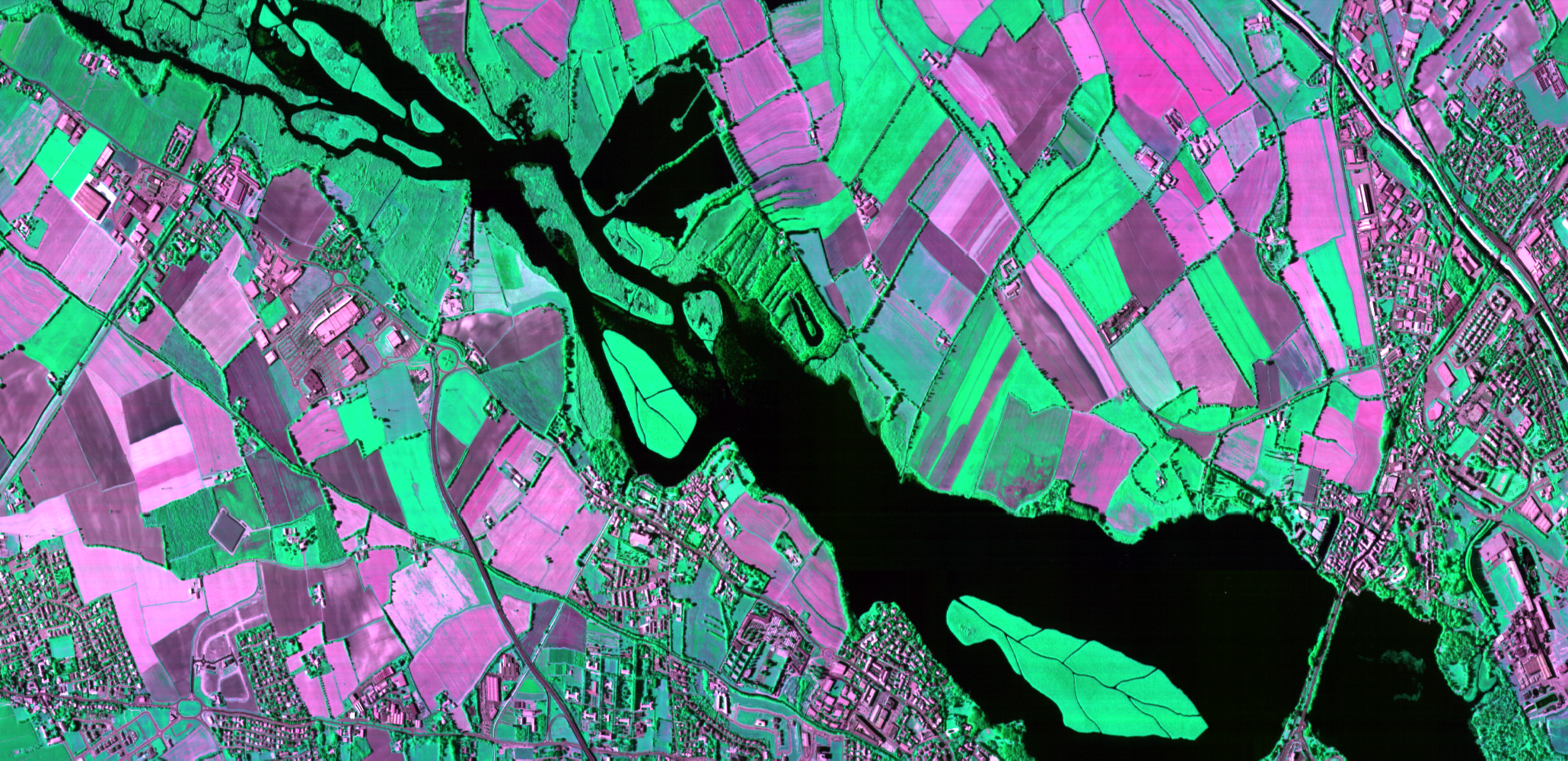
/Figure4_InterBand_TEXT%20IPT.gif?width=1548&height=825&name=Figure4_InterBand_TEXT%20IPT.gif) Illustration of IPT's radiometric and interband geometric processing – Colour-Infrared (CIR) image
Illustration of IPT's radiometric and interband geometric processing – Colour-Infrared (CIR) image
While IPT focuses on generating high-quality TOA outputs, it can be seamlessly combined with VITO’s ICOR atmospheric correction software to derive Top Of Canopy (TOC) surface reflectance products. This modular set-up supports a complete and customisable processing pipeline—from raw input to analysis-ready products.
A Seamless Workflow: CalibrEO and IPT in Tandem
While IPT does not perform sensor calibration itself, it is built to apply calibration coefficients. These calibration coefficients have either been derived from pre-flight characterisation data that the client provided, or, preferably, refined and validated through VITO’s CalibrEO service.
CalibrEO delivers high-quality radiometric and geometric calibration, ensuring consistency and accuracy in the input data. IPT then transforms this calibrated input into Level-1C top-of-atmosphere (TOA) radiance or reflectance products, using its flexible and automated processing pipelines.
Although CalibrEO and IPT are available as separate offerings, their combined use provides a seamless and powerful, end-to-end Earth Observation workflow—from in-orbit calibration to data pre-processing. Together, they offer a coherent solution for turning your raw satellite measurements into high-quality, analysis-ready outputs, fully aligned with the demands of modern EO missions and downstream applications.
From launch to insight, CalibrEO and IPT help SmallSat missions deliver consistent, high-quality EO data.
— Iskander Benhadj, R&D Remote Sensing, VITO
Complete Your Satellite Earth Observation Workflow
As satellite data continues to gain strategic importance across sectors, solutions like VITO’s CalibrEO and the Image Processing Tool (IPT) are essential components of any space optical remote sensing workflow. Together, they deliver a strong foundation for accurate, consistent, and analysis-ready Earth observation data, supporting applications that demand precision, scalability, and speed. Whether you're preparing for a new mission or optimising ongoing operations, investing in the right tools for satellite data calibration and processing is a decisive step toward lower costs, greater insight and impact.
Join Us at SmallSat Europe or Living Planet Symposium
Would you like to learn how our CalibrEO services and IPT software can optimize your SmallSat data calibration and processing? Join VITO at SmallSat Europe in Amsterdam during May 27-28 or at the Living Planet Symposium 2025 in Vienna during June 23-27. Our Remote Sensing experts are looking forward to meeting you there and showing the Earth Observation solutions we are developing for a more sustainable planet. Or just contact us if you cannot make it to Amsterdam or Vienna.


/CalibrEO%20Service%20Header.jpg)
/SmallSat%20Europe%20banner.jpg?width=864&height=475&name=SmallSat%20Europe%20banner.jpg)
/Living%20Planet%20Symposium%202025%20LPS25%20Themes.jpg?width=687&height=385&name=Living%20Planet%20Symposium%202025%20LPS25%20Themes.jpg)

