The need to optimize clean-up interventions
Waste Watchers aims to alleviate the efforts of organizations like River Cleanup, who mobilize millions of volunteers worldwide to clean up waste from rivers and their surroundings. The primary goal of these cleanup activities is to remove litter while it's still accessible, preventing it from ending up in the oceans. To this end it is crucial to optimize clean-up interventions. This was also clearly expressed by citizens in the 2022 Amai! call for ideas. We therefore teamed up with River Cleanup and launched the Waste Watchers idea in the 2022 call of Amai! for new citizen science projects to be completed in 2023.
Waste Watchers is one of the 5 selected citizen science projects of the amai! programme. The amai! programme, organized by Scivil, Knowledge Centre Data & Society (Kenniscentrum Data & Maatschappij), and the Flemish Department of Economy, Science, and Innovation (EWI), aims to increase the involvement of citizens in the use of Artificial Intelligence (AI) to answer societal problems. Waste Watchers is a unique project that enables citizens to use drones and Artificial Intelligence (AI) to detect and map litter, with the Scheldt riverbanks as the arena for our proof of concept.
Citizens and drones to search for litter
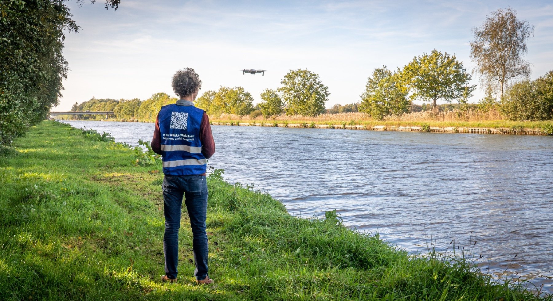
To easily map and automatically detect hotspots of waste, we started collecting drone data. Why drones? Drones, with their birds’ eye perspective, can capture a more comprehensive view and even reveal litter that is hidden due to vegetation or sloping terrains. To avoid expensive costs and complex authorization procedures, we used small, lightweight (less than 250 g), safe consumer drones that can be easily operated by a wide variety of people with much less restrictions, yielding very high-resolution imagery (around 0.5 cm). This enables a decentralized approach where both the wider public and professional organizations (public or private) can collaborate using the same tools for data acquisition, complementary to each other.
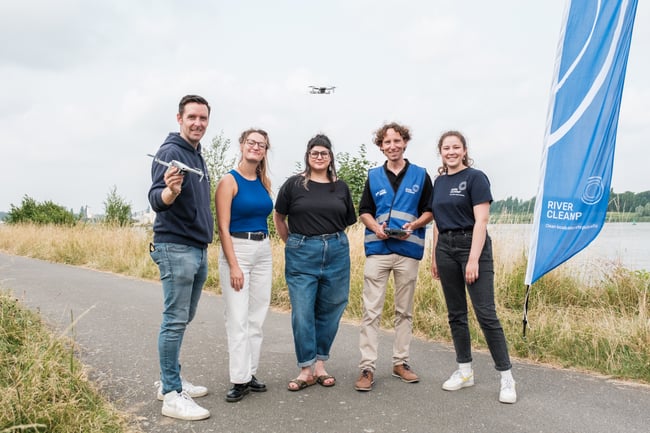
Waste Watchers is a world first. It is the first time the public is called upon to collect drone images to search for litter. At the beginning of the summer, Waste Watchers called upon citizens from all of Belgium to collect as many aerial images as possible of the banks of the river Scheldt by using drones. Citizens could either submit images using their own drone(s) or join one of the five public flight days. The call to become a Waste Watcher received an overwhelming response, reinforcing the belief in the urgent need for such a system. During the project's public fly-in days in July and August (in Wichelen, Oudenaarde, Avelgem, Gent and Dendermonde), almost 200 enthusiasts, ranging from ages 5 to 75 and from various backgrounds, were introduced to the Waste Watchers concept. The participants received information about the litter problem, objectives and setup of the Waste Watchers project, the drone regulations, and they also learned how to operate a small drone and how to collect suitable and high-quality drone images. From the 100 individual submitted flights performed throughout July and August, we gathered over 8,000 photos, covering 40 km of the banks of the river Scheldt.
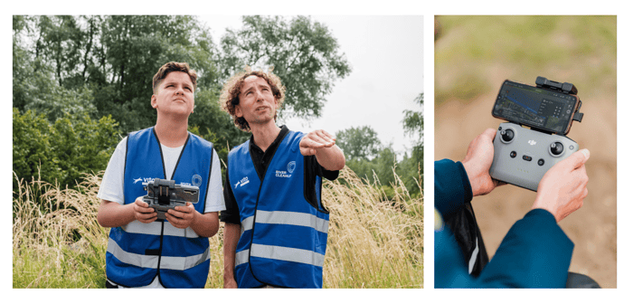
All drone images were captured following the Waste Watchers guidelines to collect data in a standardized way (itself the result of rigorous internal testing). Wherever we saw gaps in the resulting datasets, River Cleanup employees and permanent volunteers could then go out to the areas that needed additional data collection using the same methodology. We are very happy to report this turnout for a globally unique operational citizen science project appealing to the general public to submit drone imagery for environmental monitoring.
Technological implementation to automatically detect litter
To recognize and categorize litter, the project relied heavily on the annotation of thousands of images. These images were used to train high-quality AI computer models. We were very pleased to collaborate again with De Lift Education, a school for young people on the autism spectrum that focuses specifically on teaching IT skills. Their students have incredible skills in accurate labelling which is of course of great value in creating high-quality automatic detection models. Training an accurate model for litter detection on such a large extent of riverbanks turned out to be a non-trivial effort. While successful case studies have been reported in scientific literature on litter detection in water and on beaches, the operational reality of dealing with an almost endless variety of backgrounds and litter object characteristics is more challenging, and in fact very much a still ongoing effort. Currently, we continue to test several approaches in improving AI models in order to generate reliable litter maps by the end of the project.
With our MAPEO platform we have a robust and flexible setup to subject massive amounts of drone images to a quality check before sending them to the server and allow further processing. Once on the server, the images from each flight are positioned through direct georeferencing (reducing the data need compared to photogrammetry), after which models can be run and deliverables will be visualized in the online viewer.
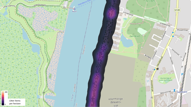 Part of the first prototype map which visualizes how many pieces of litter per hectare the computer found, where we aggregate the object locations in a heat map. © VITO Remote Sensing
Towards a waste dispersal map
The goal of the Waste Watchers project is to produce a dynamic and continuously updated waste dispersal map. Currently, we continue to test several approaches in improving AI models in order to generate reliable litter maps by the end of the project.
While the project is ongoing until the end of the year and participants are still encouraged to submit new drone imagery, each result serves as a starting point for organizations like River Cleanup. Cleanup activities are finite, and it's crucial to focus on areas where intervention is most needed. The Waste Watchers waste maps help identify these hotspots. The project's most significant strength lies in collaboration, allowing professionals, area managers, and governments to use the same platform and supplement each other's data.
/Blog_CORSA_1200x650.png)
/lewis-latham-0huRqQjz81A-unsplash.jpg)
.jpg)