How we use drones to lift plant breeding to a higher level
Group AVEVE offers various farming and agricultural products and services such as livestock, seeds, farming machines, etc. We’re active in Belgium, The Netherlands, France and Germany. We’re constantly investing in innovative technologies that stimulate and strengthen the agricultural industry. mapEO is a perfect fit in this strategy.
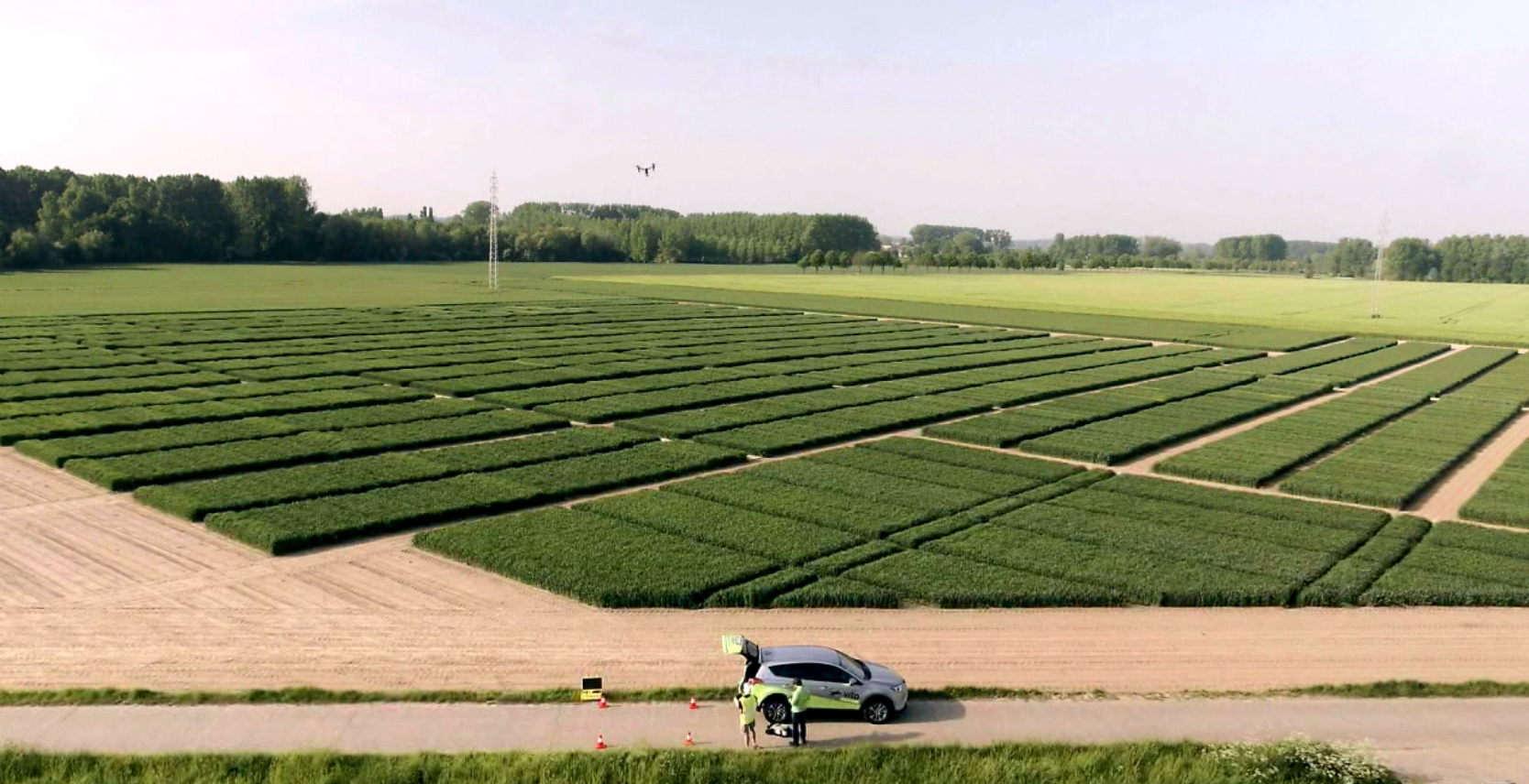
In plant breeding, the test plots are monitored with the naked eye. We look for the presence of disease and agronomical properties. Based on these checks, we give a score to the variety, and use that to decide whether we offer it to our customers. Our major challenge is to objectify this information of the experimental fields. With mapEO we can use drone data to monitor and evaluate the growth, health and evolution of new seed varieties.
mapEO for faster and objective screening
Instead of walking through all the experimental fields to check the plant characteristics, mapEO allows us to conduct our own drone flights or order a mapEO certified pilot to collect necessary data at set times using various cameras. As a result, we have an archive of images of all test plots.
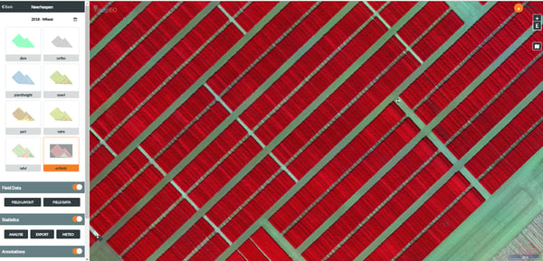
mapEO combines world class image analytics and easy to use drone technology to give us an objective screening of our breeding lines and plant characteristics. We can now also count plants with certain characteristics, and go back in time to verify why a score was given at that time. In short: mapEO gives us an even better insight in our plant varieties.
And the winner is ...
The collaboration fits perfectly in AVEVE’s innovation strategy. Innovation is one of our core values and it is essential to provide the products and services our farmers need to be prepared for the agriculture of tomorrow and help them to improve their efficiency and turnover today.
We’ve been using mapEO since November 2017 and we already see positive results. We will compare the drone based scoring with the interactive ones and then decide how mapEO can help us even better in the future.
Discover what mapEO can do for you at mapeo.vito.be.
/Blog%20Post%20Strip%20Cropping%20-%20Featured%20Image%201200x650%20150%20ppi.png)
/Blog_WorldCereal_1200x650.png)
/lewis-latham-0huRqQjz81A-unsplash.jpg)