EO for global development assistance
ESA’s Global Development Assistance (GDA) program is a global partnership to mainstream the use of Earth observation into development operations for various thematic areas.
At the request of different teams from the World Bank and the Asian Development Bank, we are developing EO based services to support specific development operations.
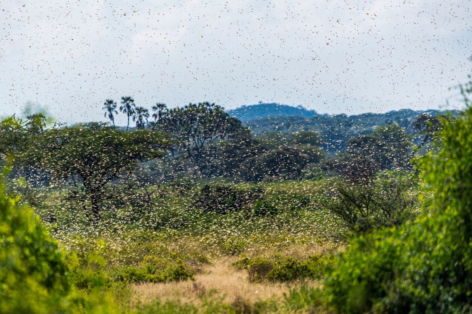
One of these requests is to demonstrate the use of EO data to support Desert Locust monitoring for the Intergovernmental Authority on Development (IGAD). IGAD is a Regional Economic Community of the African Union which aims to enhance the centralization, information spread and awareness on Desert Locust outbreaks. They operate the online platform ‘East Africa Hazards Watch’ to collect data and are now looking into opportunities to integrate satellite data.
Kenneth Kemucie Mwangi, Project Lead and Early Warning Expert at the Intergovernmental Authority on Development explains why they are interested in extending their platform with satellite data: "At IGAD we base our decision making on food security and hazards based on evidence generated from data and other information layers. Through the East Africa Hazards Watch, we are able to monitor developing drivers of food insecurity and provide early warning information in a lead time for early action. This supports the governments in Eastern Africa in quick decision making. EO data is also enhancing the quality of evidence needed for anticipatory action so that hazards have adequate resources allocated to them based on their likelihood of occurrence. The desert locust mapping services are bringing in knowledge from research and data integration capabilities to service IGAD’s co-chaired food security network who are not only interested in early warning and early action, but also on level of damage and food security impacts the transboundary pest cause. This is needed in the planning and implementation of interventions in pest control and livelihood restoration after a crisis."
A co-design approach with IGAD
Based on IGAD’s requirements, we developed two desert locust mapping services using Google Earth Engine, levering its transferability and allowing for easy testing and upscaling in other regions. For both services we use FAO’s Desert Locust Hub to collect ground observations of Desert Locusts at different phenological stages: hoppers, adults, bands and swarms. The observations of juvenile stages are used for the service to support the egg breeding area predictions. For the crop damage mapping service we use the more mature stages as ground data.
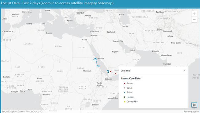
View of FAO's Locust Data Explorer
Early warning service for egg breeding areas
For the first service we focus on an early detection system for desert locust outbreaks. This application aims at predicting locust breeding grounds across East Africa and the Middle East, most popular areas for the desert locust because of the climate conditions and sandy soils. Using Google Earth Engine (GEE), we trained a Machine Learning (ML) model with actual hopper observations. Different datasets, including meteorological data, satellite data (vegetation cover) and soil moisture data (SMAP) were used as driving factors for the model predictions. The result are maps indicating the habitat suitability. This work has just started so we are currently testing the approach on historical data. We aim to tune the application towards real time predictions to be used in an early warning context for the region.
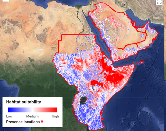
Habitat suitability of Desert Locust for East Africa and the Middle East based on a Machine Learning approach.
A service to map damaged crops
Additionally, IGAD requested a crop damage mapping service so they can easily highlight potentially damaged crop areas. Our damage assessment solution was developed in a two-step approach. First, time series of Sentinel-2 were extracted for locations where bands or swarms of desert locust were observed. How and when the vegetation signal was affected, and how this relates to the actual observations was defined using a temporal decomposition technique. Based on this analysis, we demonstrated that the damage mapping approach should be highly flexible, allowing to finetune parameters locally.
Additionally, a change detection method was developed. The application compares Sentinel-2 images before and after the damage event. The timing of comparison is flexible and largely driven by local conditions, actual observations and the movement of the locust swarms over time. These images are further translated into damage category maps.
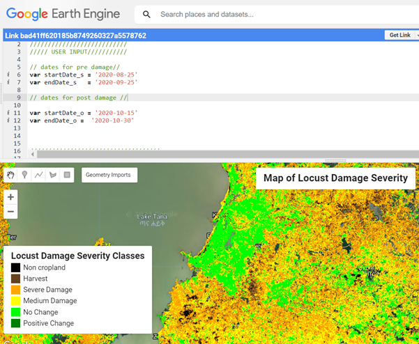
Crop Damage Assessment tool in Earth Engine using a change detection on Sentinel-2 data. Based on an interpretation of the observed change in a particular part of the growing season, damage categories are defined.
Towards an operational system
Both services are currently being tested and evaluated by IGAD. The GDA programme follows the agile development methodology with updates every six months. We are now in the first stage and getting feedback on the first results. This feedback will be used for improvement of the products and service in the second stage. The ultimate goal is of course to transfer the systems to IGAD as soon as the development has been finalized.