High resolution drones imagery in agriculture
To what extend is high resolution (<=1mm) drone imagery relevant for agricultural applications? Well, it all depends on what you need. In case you are interested in analysing the crop heterogeneity found in a particular field and moment, a multispectral drone flight (or a satellite image for that matter) is probably to date the best available technique to scan the complete field and detect particular zones with low performance. But in other cases, you want to identify the source of the heterogeneity and need to take a closer look to be able to check e.g., particular diseases, nutrient deficiency or seed quality. You can perhaps step in the field to identify the problem or can look into a less time consuming and objective solutions by using super high resolution drone imagery to automate the detection. Thanks to the AI algorithm integrated into drone processing platform like MAPEO, you can process high resolution drone imagery and speed up detailed scouting tasks. So, the quest for the right high resolution imagery begins!
A quick solution to boost the image resolution might be to use narrow lenses on your camera or simply to fly lower. For sure the detail of the individual drone images will be high, the problem arises during image processing with the alignment of the images. Colleague Sam Oswald explains more about the use of high-resolution drone imagery and how to improve data analysis in this video.
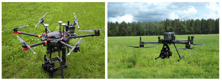
Phase One IXM100 mounted under DJI M600 (left) and M300 (right) drone
Integrating and testing the Phase One IXM-100MP
In our previous blog ‘Object detection for plant phenotyping with Phase One and MAPEO’ we already shared some insights on the use of very high-resolution cameras, such as the Phase One 100MP, to monitor crops with a higher fidelity. In the OpsDrone project we’ve continued this research and tested the P3 gimbal with the DJI M300 drone. In terms of flight time, performance and ease-of-use, it's a big improvement with respect to the integration with the previous DJI M600 drone. Let me share some of the key advantages and disadvantages we found when integrating and using the drone:
| Advantages | Disadvantages |
|
|
Three operational test cases
To truly test the benefits of using very high resolution drone imagery, we reached out to the agricultural industry to gather and process high resolution drone data of three agricultural applications: Emergence count Spinach, ear detection wheat and disease detection sugar beet. Here are some details of the performed tests:
| Test case | Disease detection Sugar beet |
Ear detection Wheat |
Emergence count Spinach |
| Field size | 0.3ha | 0.9ha | 0.5ha |
| Image resolution | 0.7mm | 1mm | 0.5mm |
| Flight altitude | 15.6m | 21.6m | 11.7ha |
| Flight time | 19min | 43min | 13min |
| Data volume (jpg) | 82.2GB | 209GB | 94GB |
| Data processing time | 3.5h | 6.5h | 4h |
Disease detection sugar beet
The image quality of the sugar beet data set was, despite the high resolution, not good enough to be able to detect the specific disease, i.e., Cercospora leafspot. This was mainly due to the abundance effect of shadows and sunglint in different parts of the images. This made it impossible for the experts to identify the diseases in the images. This dataset teaches us that, even with a great camera, the light conditions can play a big role in the accuracy of AI models. Flying the drone mission under full cloud coverage is still the best advice we can give you to generate the best possible high resolution RGB imagery.
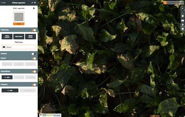
A view on the sugar beet drone data in MAPEO
Ear detection wheat
When using low resolution cameras it’s always tricky to stitch drone images over a full-grown wheat field, with plants constantly moving in the wind, and small image footprints which are zooming into the moving plants. By enlarging your area of coverage without decreasing resolution, the images of the 100MP camera also include part of the bare-soil allays which you typically can find in experimental fields. These parts of the images can be used to find the so-called key-points, important in stitching all images together and create an orthomosaic. We also developed an AI detection algorithm to count the wheat heads in our MAPEO software. This is important information to (i) determine the exact moment of wheat flowering (ii) have an early yield estimation or (iii) evaluate wheat head diseases like fusarium.
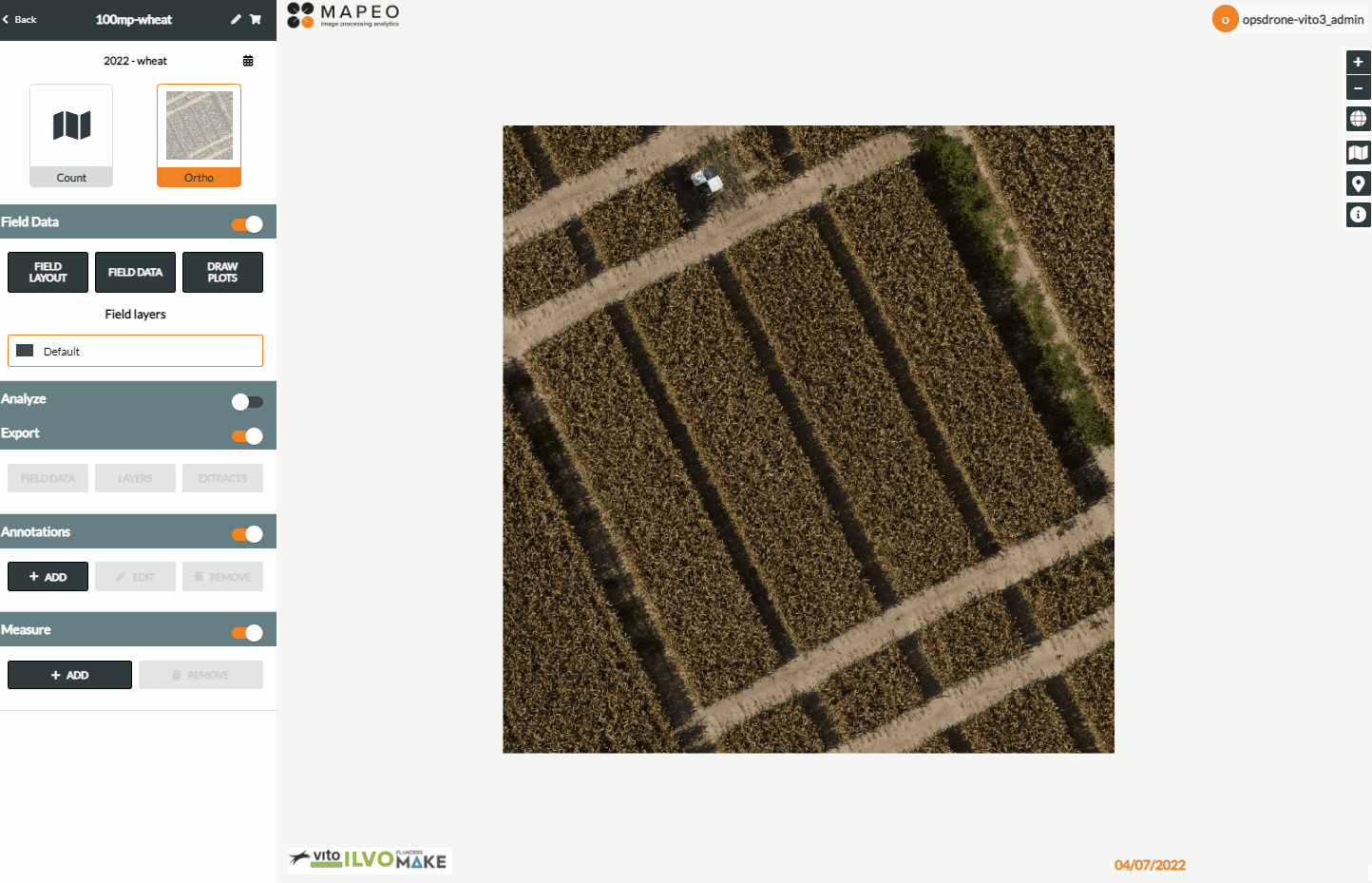
A view on the experimental wheat fields in MAPEO
Emergence spinach count
The image quality for the spinach count was extremely good. Based on this dataset we were able to develop a plant count AI algorithm. It was even possible to distinguish between 2-leaf and 4-leaf plants, important to measure early vigor. The accuracy of the algorithm dropped, but the ratio 2-leaf/4-leaf plants could be a good additional indicator of early vigor for spinach.
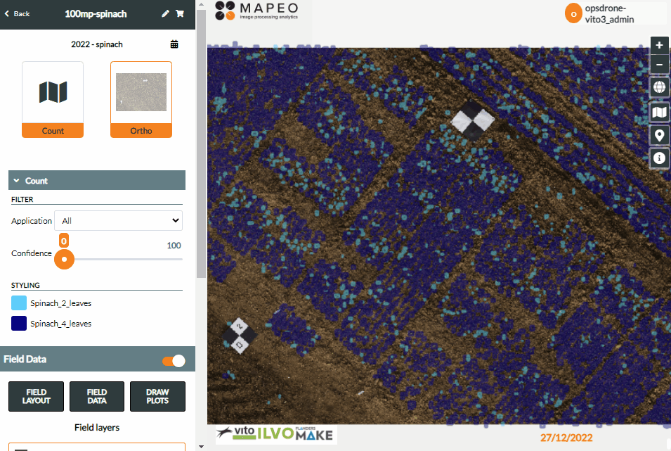
A view on the drone data collected to perform emergence spinach count
Join the OpsDrone workshop and get started with the data
Based on these results we can definitely say that the super high resolution brings large value to specific agricultural use cases and the Phase One IX100MP/DJI M300 combo can be deployed in an operational setting. For sure in the nearby future, we’ll see more high resolution camera’s being integrated into drone systems which will further boost the possibilities of drone monitoring in both experimental fields as well as production sites.
Do you want to learn more and witness a live demonstration? Register for the OpsDrone Workshop in Gent (Belgium) on Wednesday 21 June 2023.
Are you interested to get started and test the data yourself? You can subscribe via the OpsDrone project to receive a demo account of our MAPEO platform and explore these demo-cases yourself.

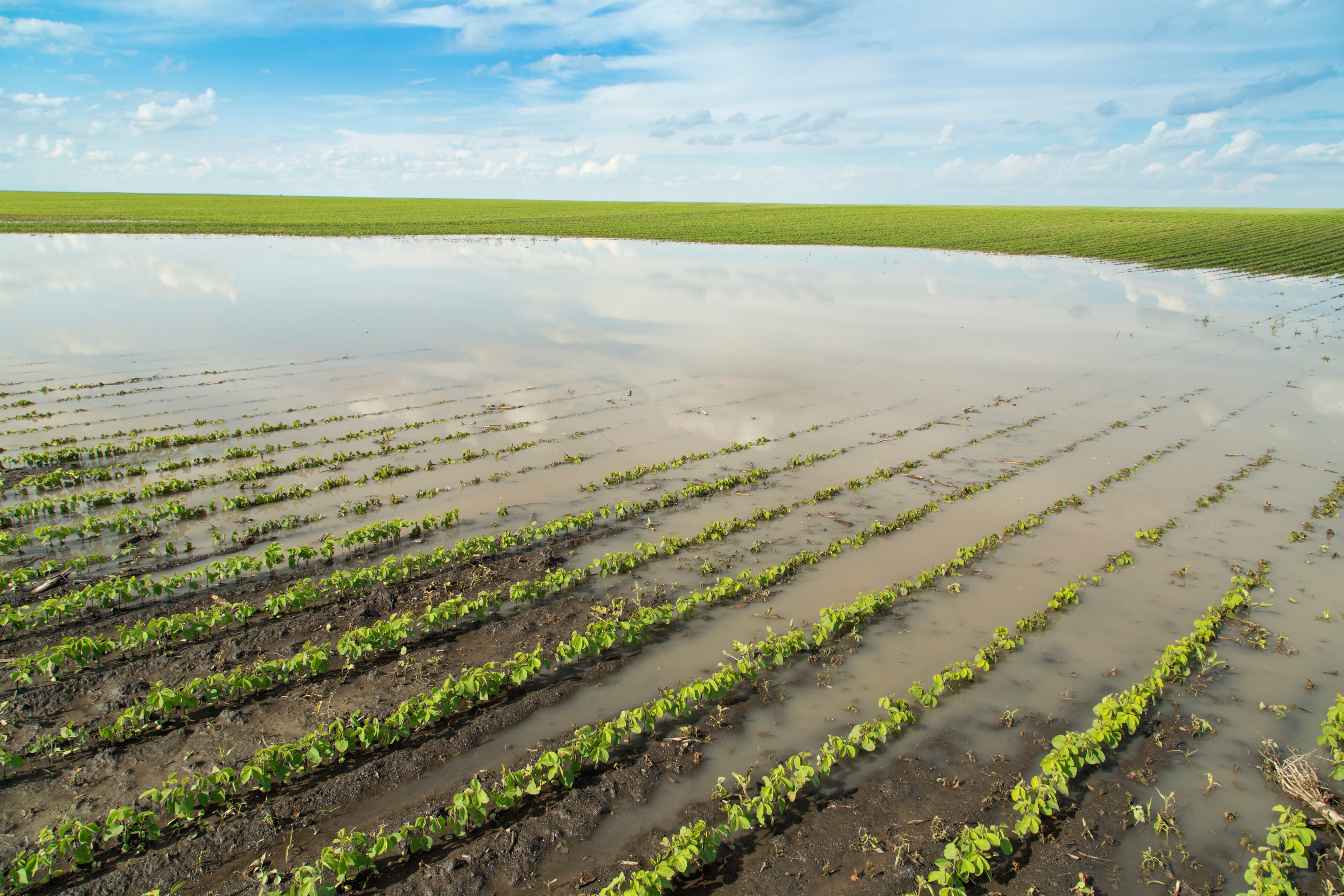
/background_image_blog.jpg)