A customized platform that meets the user needs
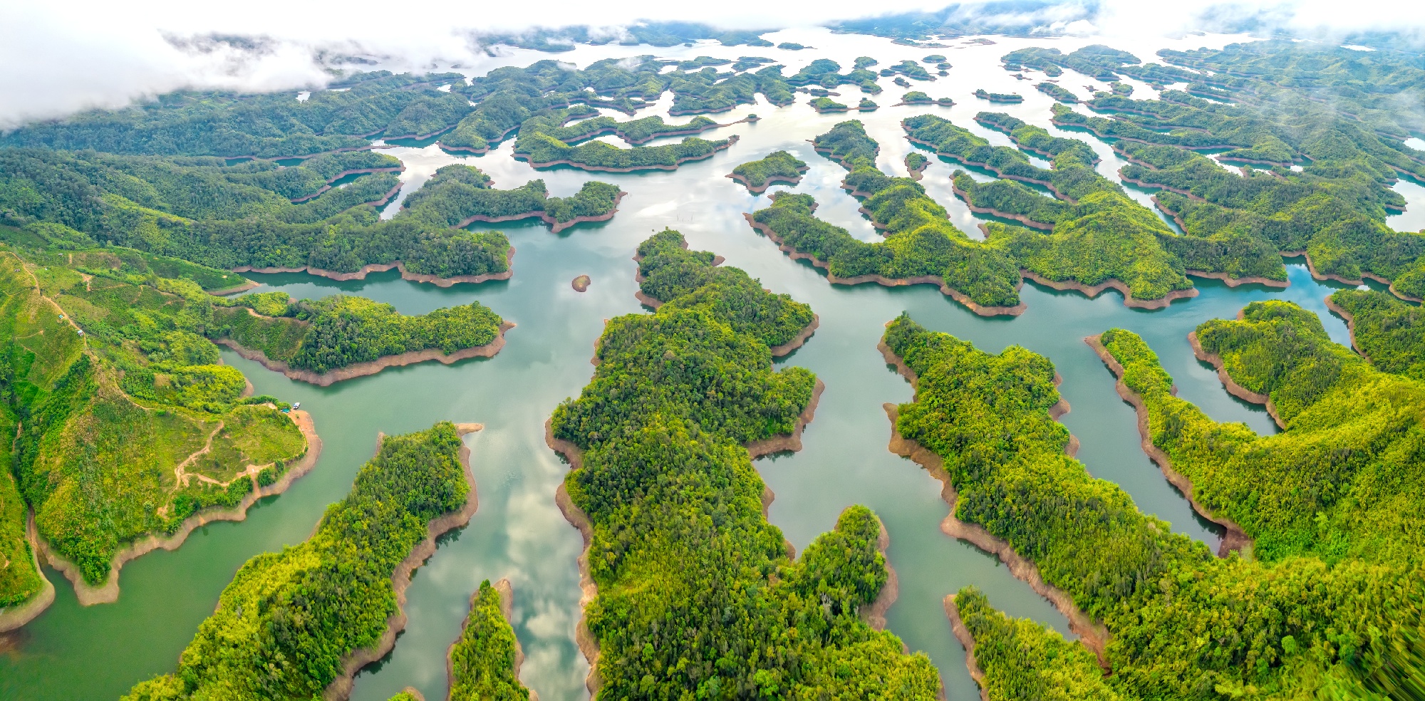
In the last few years, Vietnam is experiencing difficulties to protect and preserve the biodiversity of their marine and freshwater ecosystems. Increasing temperatures and an excess of nutrients caused by e.g. agricultural runoff can cause out-of-control algal growth in the water leading to potential harmful algal blooms impacting the biodiversity. The Institute of Geography (IG) of the Vietnamese Academy of Science & Technology (VAST) was therefore looking for a service to support water quality monitoring.
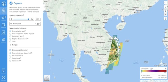
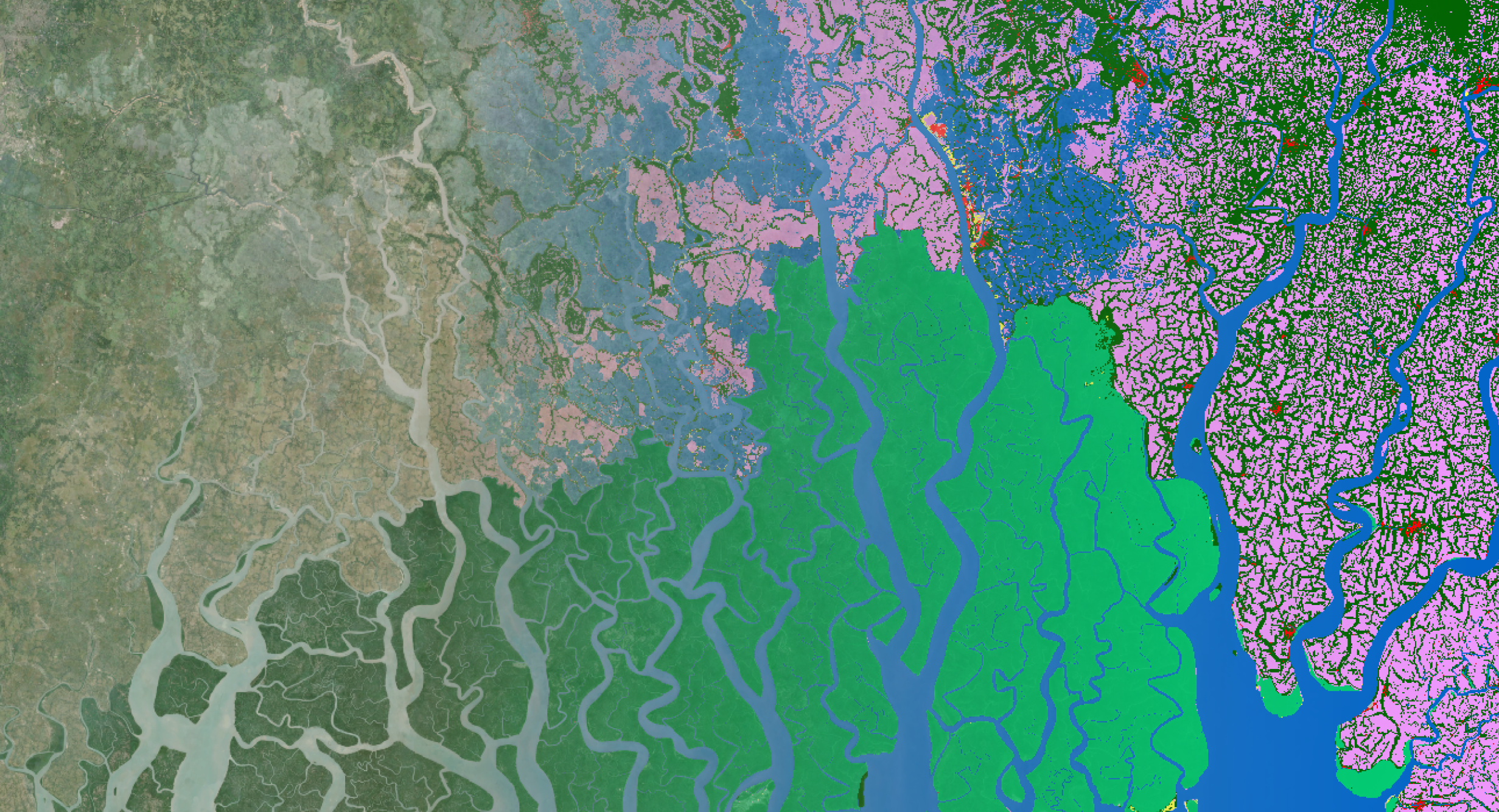
Together with Nazka mapps, a Belgian company specialized in developing cloud-based interactive map platforms, we developed EXPLORE-VN. EXPLORE-VN is a cloud-based platform that converts raw Sentinel-2 data into useful information products such as maps on turbidity or chlorophyll-a. EXLPORE-VN collects and processes new data every 5 days for inland and coastal waters in Vietnam, and provides the water quality maps via a user-friendly cloud environment. With minimal effort and some expertise in remote sensing, users can easily search the data, analyze time series and download specific datasets for further analysis.
Dedicated image processing chain and user interface
To develop EXPLORE-VN we used a validated image processing chain for water quality monitoring (including validated atmospheric correction, adjacency correction and water quality information retrieval). Managed in the cloud by Nazka Mapps, we can use virtually unlimited storage capacity and processing power. The web interface is based on the Nazka Mapps’s Mapframe, a technology stack that helps develop robust and customized mapping applications.
EXPLORE-VN provides a Graphical User Interface with a dashboard for easy client management and a credit system for resource accounting. By combining Nazka Mapps expertise in cloud environments and web interface development and our remote sensing expertise for water quality monitoring we are able to offer VAST-IG and other Vietnamese stakeholders an easy access to near-real time Sentinel-2 based water quality information products. Various statistical measures (min, max, median, …) are calculated at water body level or for a user-defined region of interest which are crucial to analyze the state of the water body over time (i.e. time series analysis) and to take necessary actions to preserve the biodiversity.
Easy access to water quality information
EXPLORE-VN transforms in near-real time Copernicus Sentinel-2 satellite images into several water quality maps including:
- chlorophyll-a
- total suspended matter
- turbidity
- trophic state index (derived from the chlorophyll-a information product)
To facilitate user uptake we organized several training sessions on how to use the EXPLORE-VN platform but also on how to perform in situ measurements for the validation of the satellite-based products.
EXPLORE-VN is a modular platform. We developed the system so that it can be expanded in the future with new satellites and new products. Depending on new applications, functions and insights, we can add additional satellite data to provide new remote sensing based information maps.
Further exploitation in Vietnam
Nazka Mapps and VITO Remote Sensing are proud to participate in the 30th anniversary of the IG-VAST on 8-9 November 2023 to present the final version of the EXPLORE-VN platform to the Vietnamese stakeholders and to officially hand over the EXPLORE-VN platform to IG-VAST for further exploitation in Vietnam.
EXPLORE-VN is a great tool that helps us monitor surface water quality from satellite images. We are very grateful with the support from Finexpo and the Belgian government. As remote sensing is an ever evolving domain, we look forward to continue our cooperation to further improve the indicators and the accuracy achieved.
The Institute of Geography of the Vietnamese Academy of Science & Technology
The project partners are grateful to FINEXPO for funding the EXPLORE-VN developments in the framework of FINEXPO’s SME instrument.

/lewis-latham-0huRqQjz81A-unsplash.jpg)