Flower counting in fruit orchards
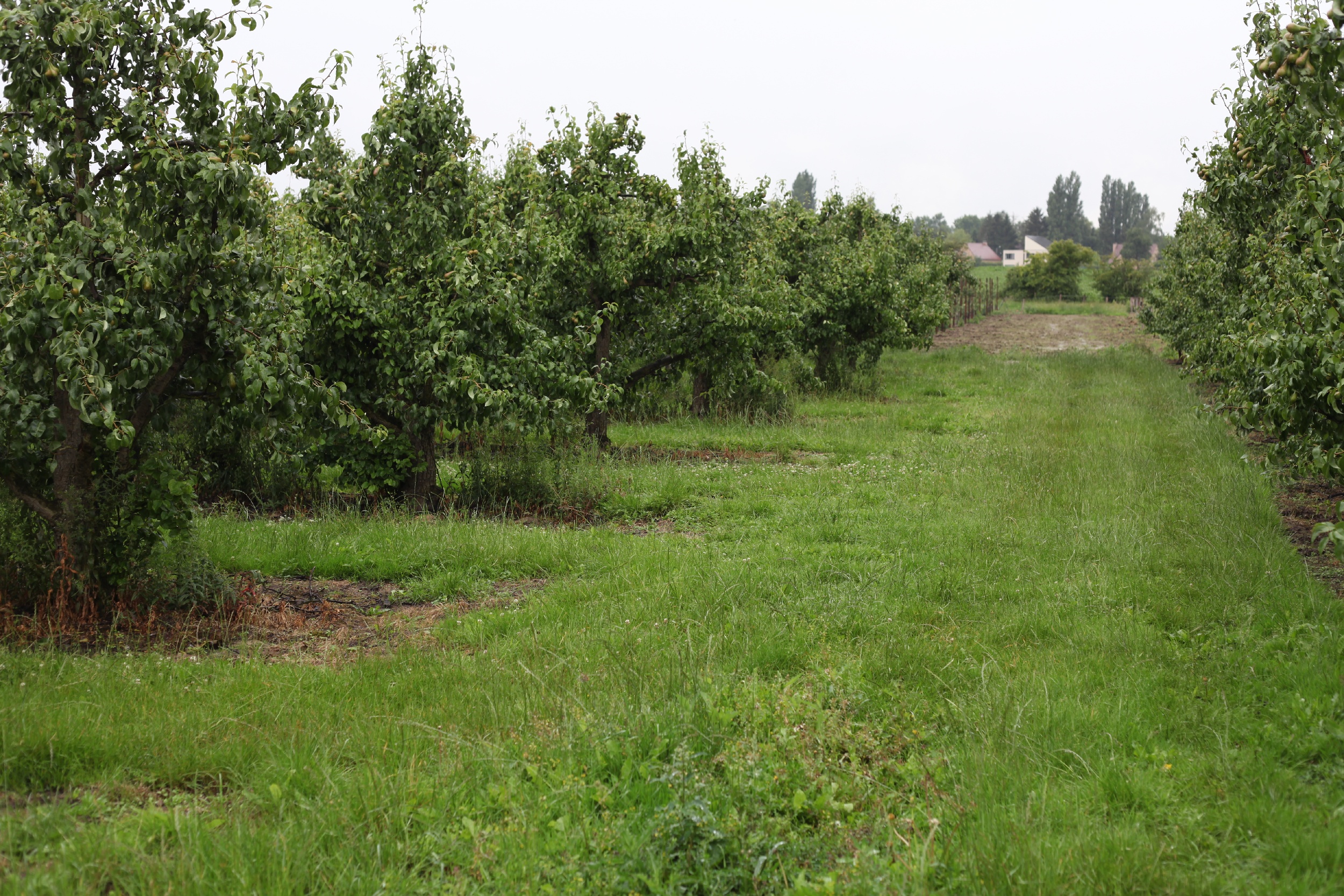
As every fruit originates from a flower, the fruit grower can often assess his yield very early in the growing season. Usually the number of flowers is much higher than the number of desired fruits, so the farmer needs to optimize the bearing early in the season already. Up to now, most of the fruit growers perform random checks with visual flower counting to monitor their fruit orchards and perform crop load adjustment to limit the competition among fruits.
By using drones to monitor flower intensity we can not only reduce time to count flowers, but also increase the spatial extent, the objectiveness, and repetitiveness of the method. Together with PhD students from the KULeuven with core expertise in fruit orchard research, and fruit experts from PcFruit, we developed a drone-based image processing platform which gives us a clear and complete view in the amount of flower clusters within an orchard.
Creating an accurate flower cluster map
When looking down on a tree, many of the flowers are not visible due to occlusion by other flowers or by the branches of the tree. Since the drone also collects oblique imagery, we are able to recreate the trees in 3D, and thus reveal the hidden flower clusters.
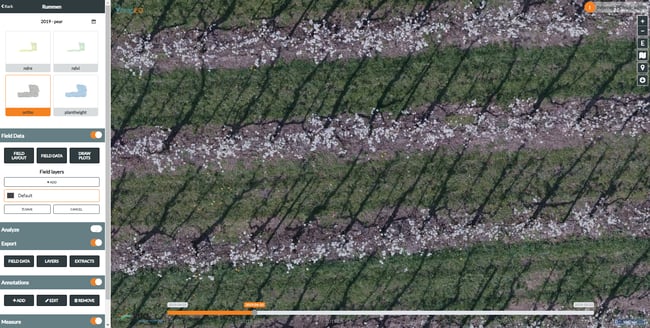 Detailed view on the RGB drone image of a pear orchard within the MAPEO FRUIT platform
Based on the differences between the 2D and 3D flower cluster estimation, we can evaluate the pruning effectiveness. Unpruned trees have a much bigger difference in the number of counted flowers between 3D and 2D, as more of the occlusion is occurring.
However, counting flowers is only one part of the solution! If we want to make a good prognosis of the expected yield at the end of the growing season, we also have to monitor the health of the trees throughout the growing season. That way we can spot trees that suffer from stresses, or are damaged by hail or frost events. But more on this tree vitality monitoring later. Let’s create a good flower cluster map first.
Data driven fruit orchard management
Our main goal is to provide added value to the fruit growers. We strive to make this spatial orchard information easily accessible through an end-to-end online platform MAPEO.
MAPEO is a drone-based image processing solution applicable in many different use cases. With the automated processing workflows you can easily generate image products such as the flower count map which is illustrated in the figure below.
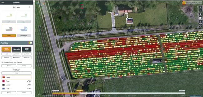 Resulting flower count map of a pear orchard on two different irrigation blocks (green and blue delineation).
Red blocks refer to trees with a low amount of flowers. Green blocks represent trees with many flowers.
The resulting flower count maps give the user a clear overview of the flower intensities. Fruit growers can spot clear patterns when large variations in lower intensities occur as for example in the flower count map above. The four, almost completely red (low flower intensity), rows correspond to four rows planted with another pear variety with indeed a limited amount of flowers. Two different irrigation blocks are shown in the flower map (delineated in blue and green).
Based on these efficient generated flower maps, fruit growers can make decisions on applying fruit setting or thinning agents. This way, the optimal amount of fruits can be regulated early in the season to limit competition between fruits and as such obtain high quality fruits with a good market price.
A platform for multiple information products
I now focused on the main features for flower detection, but MAPEO has much more to offer. It can support you throughout the whole growing season to ease your decision making on e.g., irrigation steering, fertilizer and fungicides application. Even decisions on where to perform root pruning can be deduced from the available maps. Following maps are already available in MAPEO:
- Flower counting
- Disease detection
- Plant height
- Greenness
- Biomass/ vegetative growth
Click here for more information on this fruit research or feel free to contact us for a personal MAPEO account.
Acknowledgements:
Yasmin Vanbrabant, KUL; Joke Vandermaesen, PcFruit, Laurent Tits, Klaas Pauly, Wouter Dierckx
/Blog_WorldCereal_1200x650.png)
/lewis-latham-0huRqQjz81A-unsplash.jpg)
/background_image_blog.jpg)