Water quality processor
At VITO Remote Sensing, we have developed, in the framework of the FP7 INFORM, FP7 HIGHROC and H2020 DCS4COP projects, a Water Quality Processor including the iCOR atmospheric correction and adjacency correction for deriving remote sensing reflectance, turbidity, total suspended matter, Chlorophyll-a,... from high resolution (10, 20 or 60 m depending on which spectral bands are used) Sentinel-2 images.
An archive of these Sentinel-2 water quality products is available since July 2015 for various inland and coastal regions including Flanders.
These high spatial resolution data have demonstrated to be very useful to detect and monitor the dynamics of algal growth in rivers, canals, swimming and recreation waters.
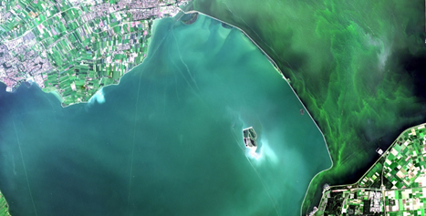
A time lapse of Sentinel-2 true colour satellite images, from mid-May to mid-Nov 2020 of Kallemoeie-Papelenvijver is shown below as produced using Terrascope.
 Fig. 1. : Time lapse of Copernicus Sentinel-2 true colour images of Kallemoeie-Papelenvijver
produced with Terrascope.
"Remote sensing using satellite data is a promising tool to detect and monitor algal blooms. The dynamics of the algal bloom is clearly visible in the time lapse. "
Jeroen Van Wichelen (INBO)
Watermonitor viewer
Sentinel-2 based Chlorophyll-a products are produced by VITO Remote Sensing and have been compared with in situ Chlorophyll-a measurements provided by the Flanders Environment Agency (VMM).
The results for Schulensmeer, a recreational water body in Flanders, for 2017 are shown here:
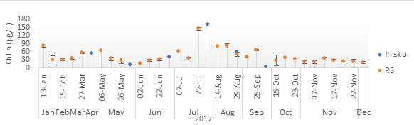
Fig. 2. : Comparison of Sentinel-2 based (RS) and in situ Chlorophyll-a concentration for Schulensmeer
for the year 2017.
To respond to the VMM user needs, a near-real time viewer, the WaterMonitor, was setup integrating Sentinel-2 based Chlorophyll-a images and VMM in situ Chlorophyll-a data in close collaboration with the EODaS programme (Earth Observation Data Science) of the Flanders Information Agency, interactive mapping partner NAZKA Mapps and VMM. The WaterMonitor allows the VMM to easily search, navigate and monitor Chlorophyll-a temporally and spatially for Flemish water bodies.
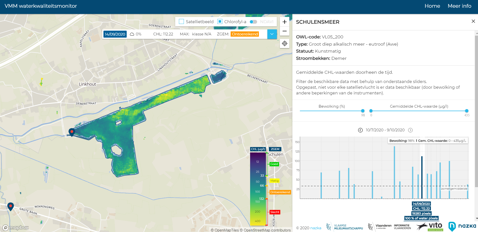 Fig. 3. : Chlorophyll-a concentration in Schulensmeer on 14 September 2020 as derived from Copernicus Sentinel-2 images and processed by VITO.
These space-based Chlorophyll-a images brought to environmental agencies via customized online web services, can help them to monitor algal growth and timely take measures if needed.
The WaterMonitor is a contribution in taking new steps in introducing digital transformation and innovation in the Flemish Government.