What's a Virtual Machine?
Enter the world of cloud computing. In this world, the cloud doesn’t only hold all the data you need. It offers the ability to process that data following your instructions. In practice, a data center full of processing servers and storage is made available to you, and you interact with it through a virtual machine.
With an additional desktop on your computer, which runs on a server in the data center, you’re all set to access, explore and process the data you want. You can save on time (avoiding to wait until downloads are done) and on investment (no additional storage or computers to buy). Instead, you can start work immediately.

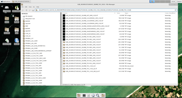
A preview of a Terrascope Virtual Machine providing a series of data and tools
All-in-one service
Terrascope's Virtual Machine provides a series of data and tools. One of the biggest assets is that Terrascope provides the data in useable formats, like GEOTIFF, and pre-installs software to work with the data on the Virtual Machine:
- QGIS and GRASS: open source geo-information system
- Developer tools, e.g. to write python or R scripts
- SNAP, the Sentinel Application Platform for satellite data processing
Also, we provide ready-to-use products based on the satellite data:
- Atmospherically corrected Sentinel-2 imagery
- Biophysical parameters, like NDVI, FAPAR, LAI, FCOVER, CCC, CWC
- Georeferenced Sentinel-1 backscatter data and 6-day coherence
- The entire SPOT-VEGETATION and PROBA-V archive
- The entire Copernicus Global Land Service archive
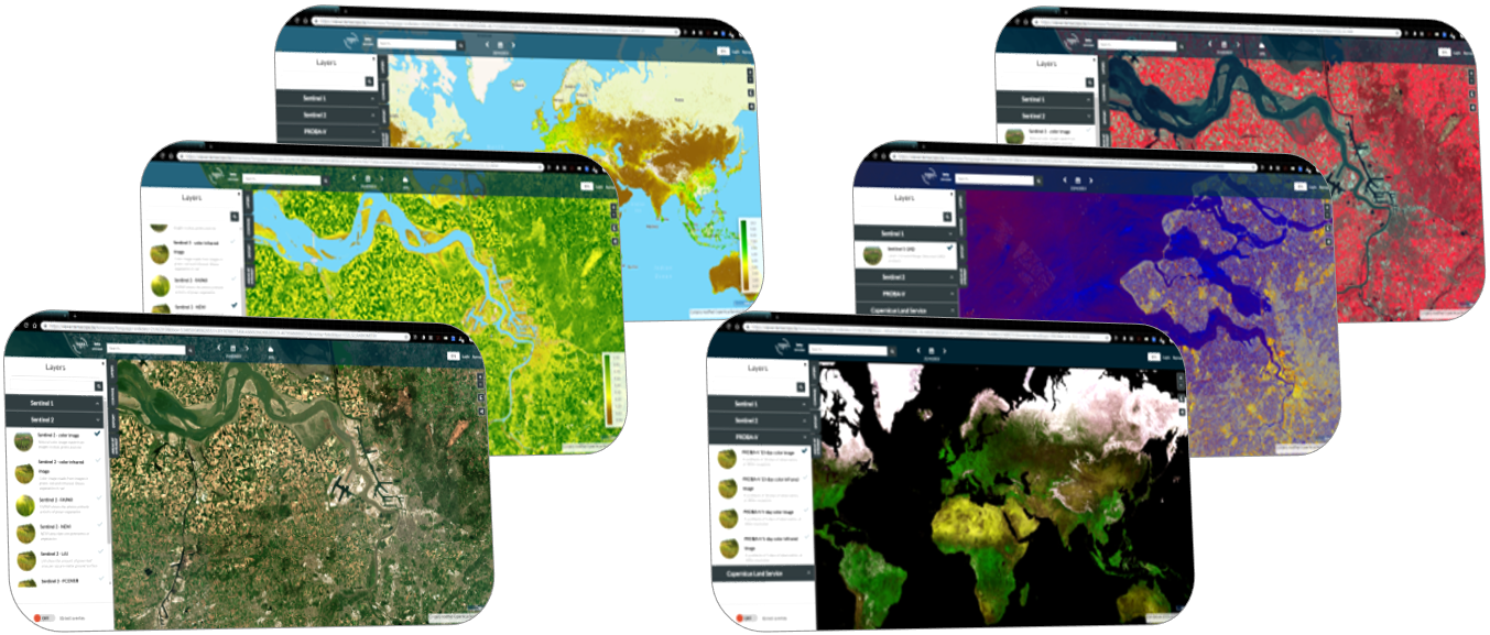
 Via the EO browser Terraviewer you can easily access a set of ready-to-use products based on satellite data including Sentinel-2 natural color, Sentinel-1 GRD, PROBA-V syntheses, Copernicus Global Land, etc.
Your data, your algorithm! You're in control
You can install any of your favorite software tools that you want to use, since you are the administrator of the virtual machine.
Terrascope’s Virtual Machines are easily accessible but at the same time guarantee full data privacy and security. Your data and algorithms are yours only and will not be shared with third parties nor the experts behind the platform. This also means that you’re responsible for making back-ups. You can download any results you want to keep, and to store your programs in an external repository e.g. Github.
We do encourage interaction between our users to facilitate data and knowledge sharing. For this purpose, a public folder is available so you can easily exchange data, codes, … with another VM user.
Get started now and START SAVING money
Setting up a Virtual Machine will take about one working day. You'll receive 4 CPU's, 5 GBytes of RAM memory and 80 GB of HDD disk space to get you started, and this completely free of charge.
- Use your Terrascope account or request a login if necessary.
- Request an OpenStack Virtual Machine in the Services section of the website.
- Submit your request form and indicate when you need the VM.
- You’ll receive a confirmation within 48 hours.
- Receive your VM and get started. You’ll receive an email with guidelines to access your personal VM.
As soon as you're all set, you’ll have access to the complete Terrascope data archive as well as a powerful set of tools and libraries to work with the data (e.g. SNAP toolbox, GRASS GIS, QGIS) or to develop-debug test applications (R, Python or Java).
If you have any questions, would like (technical) support or need more resources for operational use or on a project base, don’t hesitate to contact us or check the documentation on the website. You can also watch a short video tutorial on how to request a Virtual Machine .
Register yourself now and start exploring our ways of interacting with the data and tools!


/lewis-latham-0huRqQjz81A-unsplash.jpg)

/boudewijn-huysmans-_iyh6g5KHQA-unsplash.jpg)