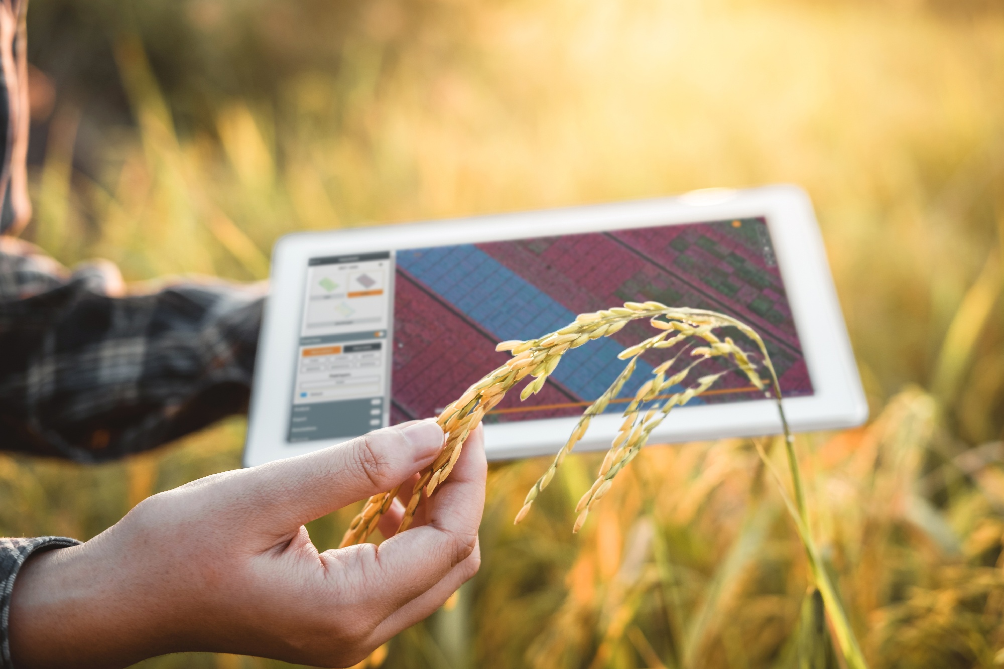
Finding the right balance with satellite data and drone data
Monitoring agricultural fields with remote sensing is already as old as the hills. With the constant technological and business innovation happening in the sector, various applications are emerging rapidly. Satellite based services for precision agriculture and drone-based phenotyping solutions for experimental fields have for instance found a niche market which rightly balance the scale of operation with the required resolution (temporal and spatial), flexibility and most importantly price.
New business and technology innovations are likely to happen for which improved information is provided at an ever-decreasing cost. But innovation can also happen by looking at synergies between the different remote sensing services, looking to overcome possible blank spots in today’s offering by connecting and integrating information from different sources. At VITO Remote Sensing we’re integrating data from drones and satellites through operational platforms like Terrascope, MAPEO and WatchITgrow. It allows us to link insights from experimental fields with insights from operational farmer fields regardless of the data source and at all stages of (and even before) the growing season.
Operational solutions for phenotyping
Phenotyping crops in experimental fields is a great example of where drone technology can offer excellent value for breeders and agronomists. Drones allow us to measure traits of interest in a scalable and objective way. Counting plants and gaps, scoring diseases or even more complex traits like yield are only a few of the examples which are integrated in operational workflows.
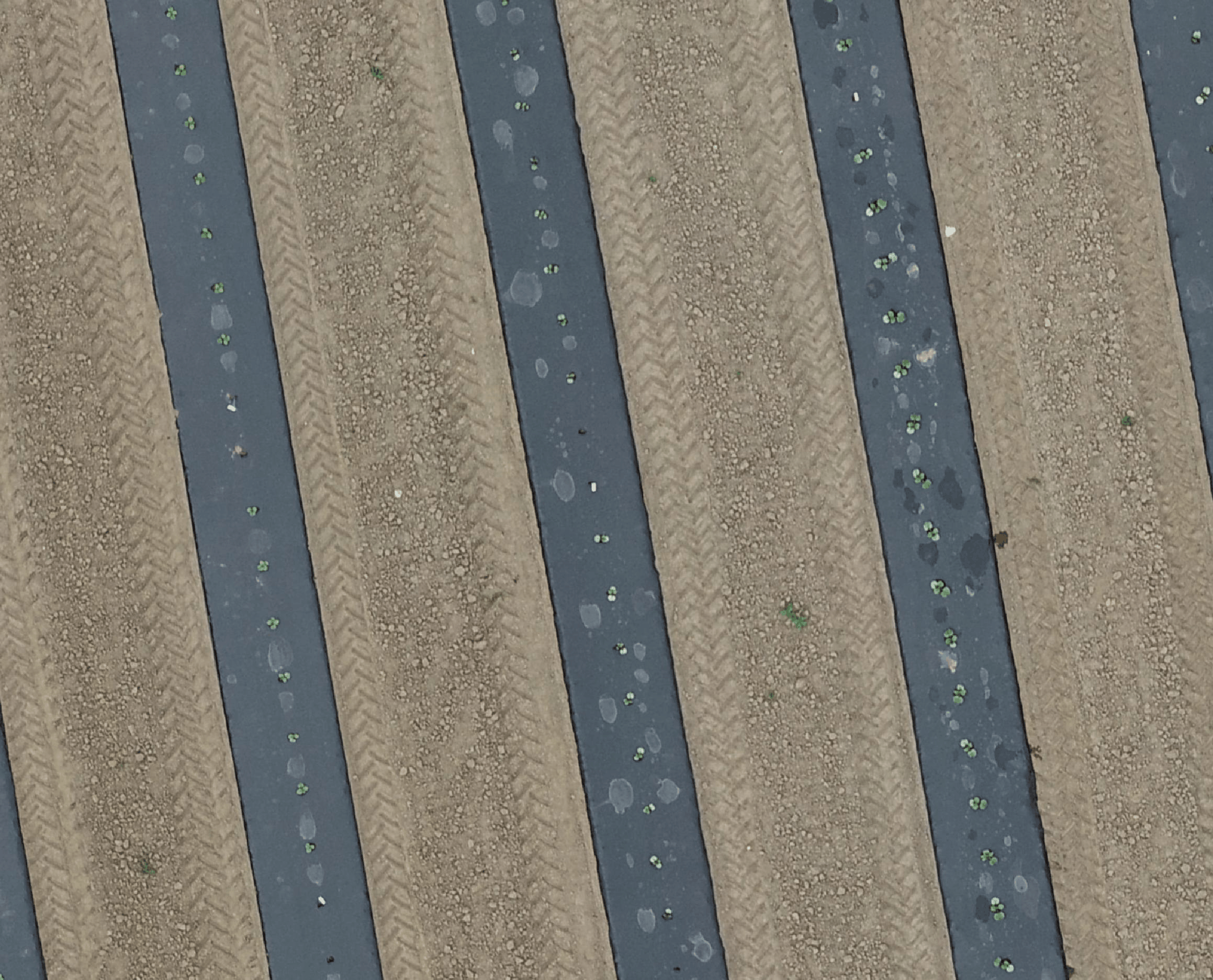 Collection of drone imagery over a pumpkin breeding field
At first sight you might think that the coarser resolution of satellite imagery will hamper practical use of its data for experimental fields. Think again! Long before you started your experiment on a particular field, satellite imagery has captured the soil heterogeneity over many growing seasons. While you have been spending money on expensive repetitive plot designs to capture environmental heterogeneity of your experiment, the information was already available from historical satellite imagery. The animation below is an example of historical yield potential maps, synthesis products of all Sentinel-2 imagery focusing on the biomass differences in a particular year. These examples clearly show the power of using these satellite-based information maps. We integrated these satellite-based maps into MAPEO, our end-to-end phenotyping solution, to offer our users the possibility to identify the best possible fields for future trials in unknown regions.
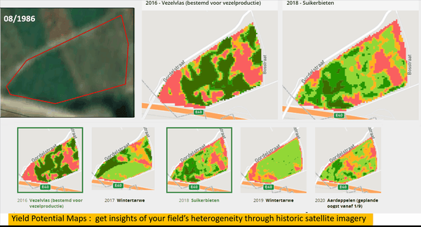 Example of historical yields potential maps
Also, during the growing season, high resolution satellite imagery - from e.g., the Planet constellation - can provide you interesting information on your trials. Just like drones, satellites carry multispectral cameras which can assess plant biomass and health status on individual plot level. While currently the location accuracy of such high resolution is limited, the temporal resolution and consistency surpasses that of any drone service. We are looking into innovative solutions to improve their geometric accuracies and integrating Planet products into our phenotyping platform.
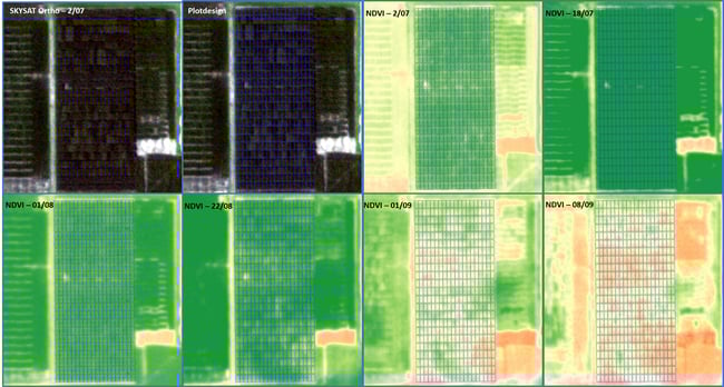 Example of high resolution satellite data over an experimental maize field
Evaluating performance on farmers' fields
On average it takes 5-10 years before new varieties enter the commercial market. In that time period the seeds are tested in a large variety of soil and climatic conditions. However, how do you assess as a plant breeder the quality of your product beyond the typical trial setup? Wouldn’t it be of great value to get information on the performance of your variety on farmers’ fields with an even larger variety of soil, climate and management practices? Satellite information integrated into farm management systems like WatchITgrow can easily provide such information. This will open new business opportunities for seed companies to valorize their in-depth knowledge of plant performance as a service towards farmers and get information back from these production fields to feed the selection process of future seeds.
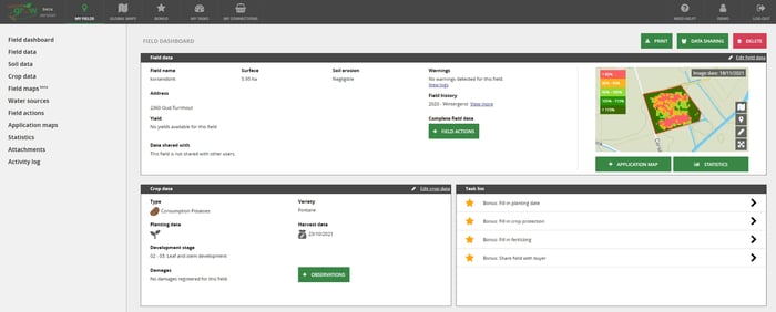 Gathering data on the variety performance on production fields via the WatchITgrow platform

/Blog%20Post%20Strip%20Cropping%20-%20Featured%20Image%201200x650%20150%20ppi.png)
/Blog_WorldCereal_1200x650.png)
/lewis-latham-0huRqQjz81A-unsplash.jpg)