Golden standard of customer experience
When you order something online, you expect it to go smooth and easy. In a world where Airbnb, AWS, Uber and other pioneering companies have set the standard for online services, users expect to be able to place an online order in just a few clicks. Why should this be any different when ordering online drone services?
Now, OK, I already hear you thinking ‘Ordering a drone service is quite different than ordering a book or taxi!’ and you're totally right! But that doesn’t mean it can’t be easy, or better said, made easy. The drone market may not yet be as mature as the shopping or tourist industry, customer experience is key to further growth and market adaptation of drone technologies. That’s why we are constantly improving MAPEO, our end-to-end platform to streamline data acquisition campaigns, image processing and online hosting of both the raw data and derived information products. Let’s take a closer look to some of the new, improved or upcoming features.
Order management and instant pricing
Let’s say you want to perform a plant count on one of your agricultural trial fields. One of the first actions is planning the drone flights and get a quick overview of the operational costs of the flight and image processing. In the MAPEO platform you could already plan your drone flights based on a selection of products, and now you can also get direct price information. No hidden costs for additional analysis, small letters, or exceptions for large datasets. You can easily indicate if you will execute the flight with your own drone pilot or need to hire an external pilot. MAPEO translates your drone product request into clear drone mission specifications. If you use your own drone pilot, you immediately receive all pricing information. In case you need an external drone pilot, a request will be send automatically to a network of drone pilots who will provide you all necessary info. Both internal and external pilots can use MAPEO’s field software to check whether the quality of the data meets the necessary requirements immediately after the flight. This allows the pilot to quickly intervene and redo the flight immediately if needed where previously this was only discovered once back in the office.
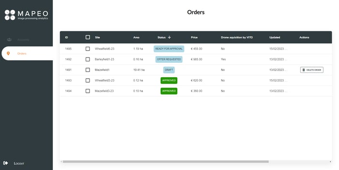
MAPEO's order management dashboard
Once your new order has been confirmed, you follow up the status of every individual mission, assign drone pilots and communicate on a day-to-day basis in our user-friendly platform. What is flown? When? What is the quality of the data? Something unexpected happened in the field and I need to notify the pilot or even postpone the flight for example! This means you can stop sending emails and start using MAPEO as your end-to-end drone management system!
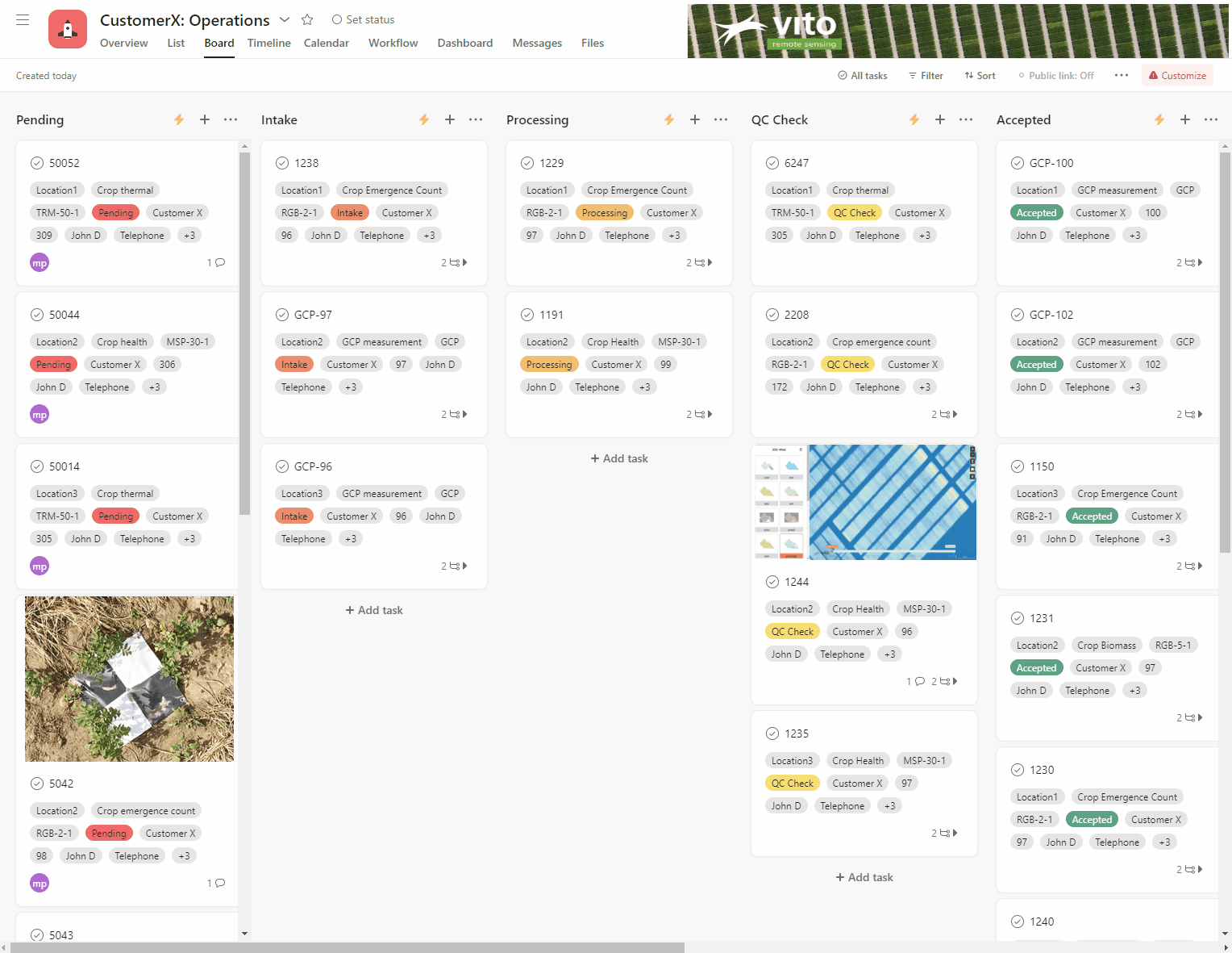
A view of MAPEO's operational mission management dashboard
From drone data to specific end-product
Where many drone processing solutions focus on processing your data into orthomosaics and digital surface models, MAPEO immediately offers application specific end-products like plant gap count, algae concentration in the water or ship detection. Each of these products have specific drone mission requirements, a set of quality parameters and processing steps. MAPEO controls the complete data acquisition and analytics workflow to assure data quality from the drone flights up until delivery of the end results for your application.
Once the end-products are available, you can start extracting specific information. This can be done manually, from the user-interface or via our API which provides the possibility to scan your account for new products and automatically extract the required information into your own database. No more waiting or checking for updates.
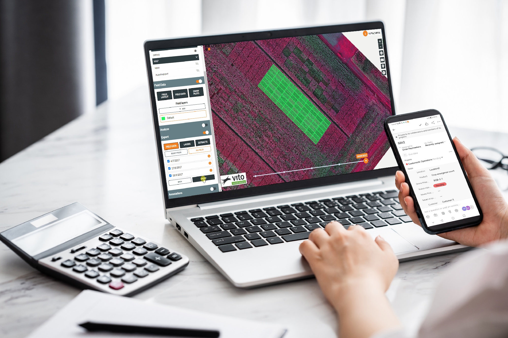
An example of how to use the GUI for exporting plot statistics (phenotyping use-case) is given below.
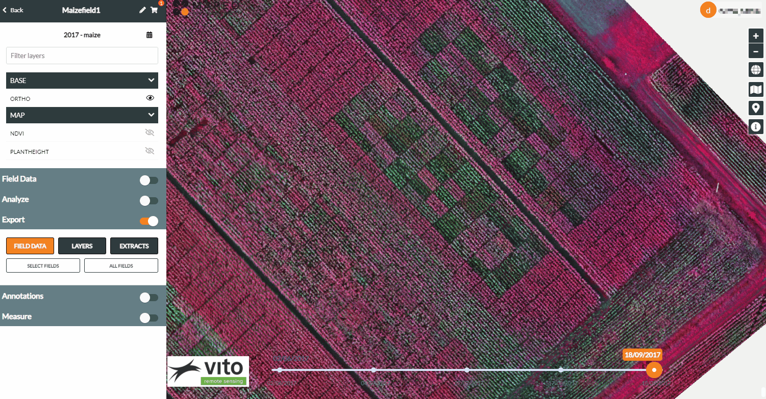
An example of how to extract plot statistics via the MAPEO platform
Do you already have an account and want to start working with our API? Click here to discover the instructions.
Customer onboarding and help center
MAPEO may be an end-to-end platform, sometimes a little support can be very helpful. Something didn’t go according to plan! Did your reference points disappear from the field? Or do you want some additional advice to get started? You can easily find more information, guidelines and manuals in the MAPEO online help center. Whether you are a drone pilot, a project manager, a field manager, a data analyst, or simply interested to learn more about the basics of MAPEO, the help center is there to support you on your journey to maximize the usability and efficiency of your drone data analysis workflow.
All of our workflow processes are documented and updated whenever new features are integrated, or clarification of existing features are needed. If you cannot find a useful answer in the help center, you can also submit a request to ask for more assistance from the MAPEO support team. Our experts are happy to assist whenever needed.