Digital transformation of society and the digital twin
Meeting with policy officers responsible for operational resource management in various domains, I often hear the same feedback, similar struggles and corresponding requests. Where they used to work with advice, reports and estimations, they now want to base their decisions on data and facts. And the requests can be diverse. From drone-based corridor mapping to enforce environmental policies over establishing a continuously updated spatial database of doorbell counts via mobile mapping to monitor migration patterns in a city.
A decade ago, the city council made decisions based on expert reports, sampling and impressions. Nowadays, everything is required to be data and fact based, we need to provide the numbers behind the reports and impressions”.
Reynvoet Hilde, Director of Housing at the City of Ghent
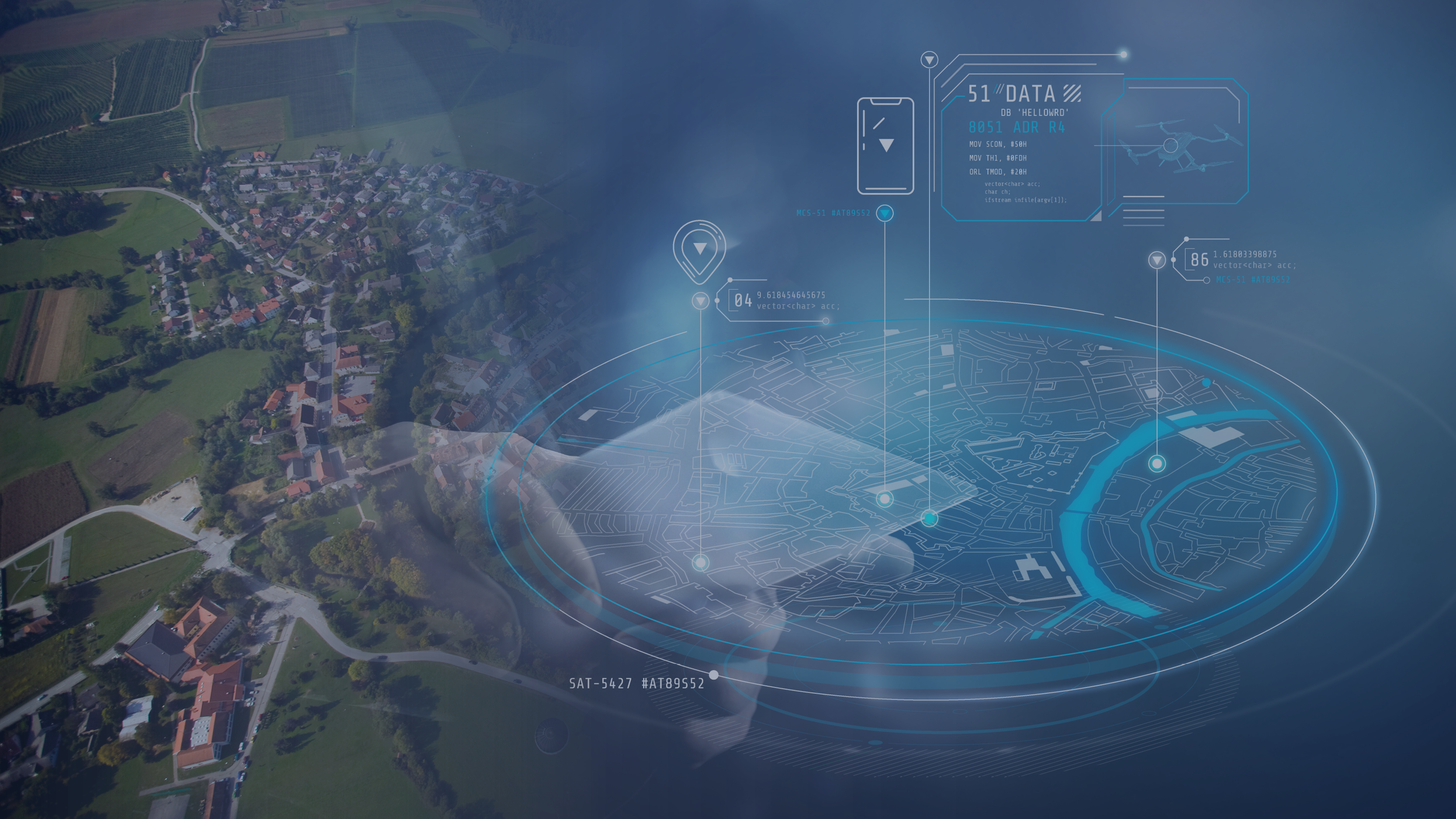
Local management of resources (land, water, infrastructure, materials, and energy) and situations (change, security, mobility, social patterns) is expected to be data driven, since we now have the technological capacity to continuously monitor, measure and handle massive amounts of data. This is currently being framed as “digital twin” technology. It is a natural consequence of the emergence of cloud computing, web services, sensor networks and social networks from around 2005 onwards. We clearly entered an era of digital transformation where remote sensing as intelligence source has become more relevant than ever before!
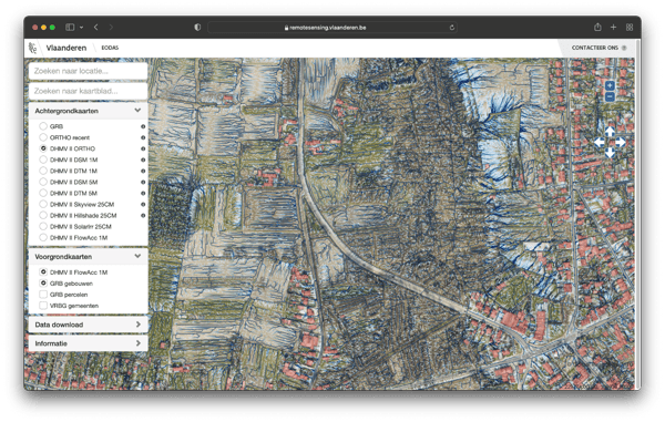
LiDAR (16 points/m2) and orthophoto (20cm resolution) based Digital Twin of Flanders for environmental and civil infrastructure resource management and enforcement applications. The example here shows the LiDAR derived overland flow patterns as part of an integrated water resources management.
Intelligence information at the right temporal and spatial resolution
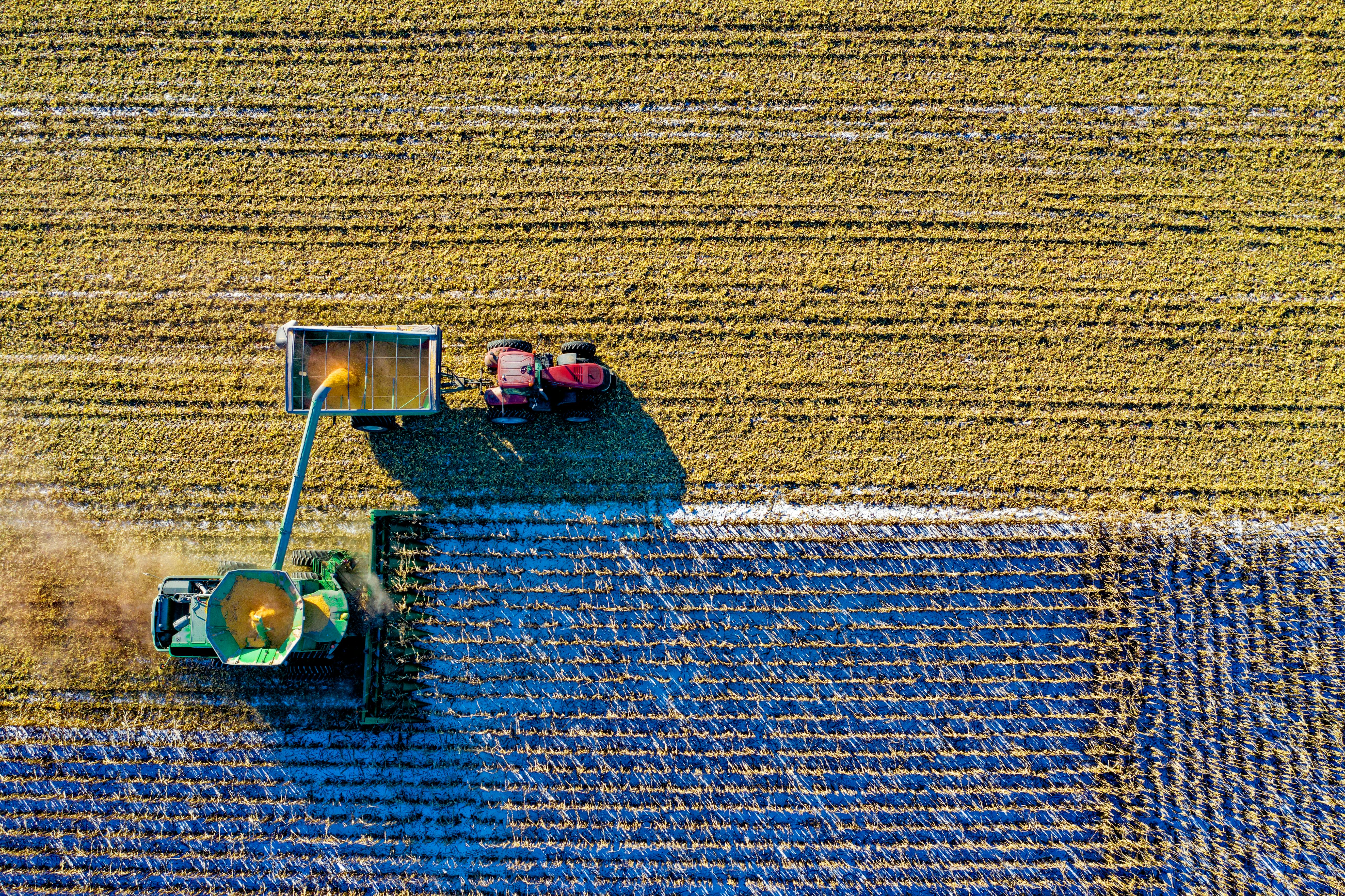
Data resolution – both in space and time – is key for the useability of the information services of our networked society. For many decades airborne and terrestrial remote sensing was and still is the default intelligence source for local governments and companies because of the supreme data quality for visual or computer aided quantitative information gathering. Nowadays, thanks to the advent of small drone systems, remote sensing has become a measurement technique for everyone. The relevance of small drones is rooted in neither unique missions nor economy, but rather in the operational impact of simple logistics. In an operational sense, they are direct support assets for the unit employing them and enable to gather data at the spatial and temporal resolution their applications require.
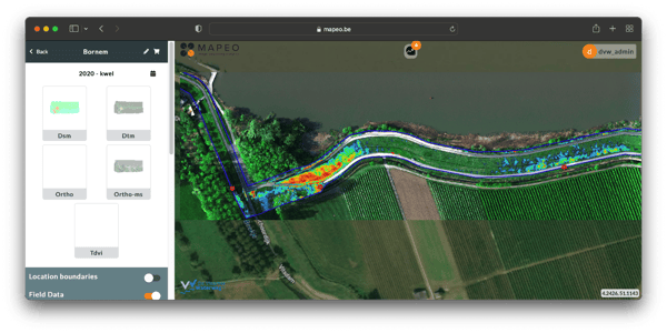
An example of assessing seepage risk in a dike section requested by the ‘Vlaamse Waterweg’. Based on 2 drone flights on the same day (early morning and evening) we were able to measure the temporal temperature gradient. Terrain elements that warm-up slower than average due to the higher water content can be considered as seepage risk zones. The red stars indicate the expert sample knowledge (visual inspection) of seepage occurrence.
The last years, data acquisition has become more accessible. You can relatively easily install different sensors (RGB frame cameras, hyperspectral line scanners, LiDAR and sonar point scanners, …) on drones, cars, boats, airplanes, helicopters, etc. However, after some experiments, many companies realize that data acquisition is only a first step and that it takes a lot more expertise and investments to convert the raw data in intelligence information products. Therefore, we developed “MAPEO”, a modular and customer-centric remote sensing platform to streamline data acquisition campaigns, image processing and online hosting of both the raw data and derived information products.
Application services at the right customization level
MAPEO supports a broad spectrum of remote sensing sensor solutions. To name a few: LiDAR for very accurate and detailed 3D applications, high resolution photographs for various object detection applications, hyperspectral cameras for phenotyping or water quality applications and mobile mapping for all kinds of civil infrastructure asset management. Thanks to its modular approach, MAPEO can support various sensor types with associated processing techniques.
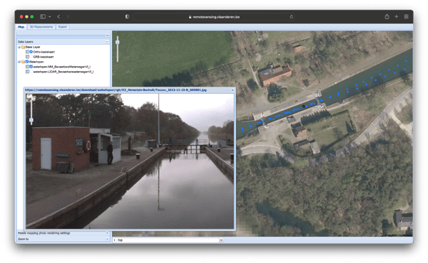
Mobile mapping (panorama camera on a boat) example for asset management along the navigable waterways.
Being actively involved for several decades in a multitude of operational use-cases in the domains of land, water, energy, materials, infrastructure and security, we experienced an increased need for a processing platform that supports companies and governments in continuous measuring via remote sensing. The MAPEO base configuration can therefore be tuned to the specific application needs of an organization and offers different services for:
- data acquisition campaigns (flight preparations and quality control)
- standardized photogrammetric and radiometric processing
- online access to hosted data products
- data archive and data life cycle management
- application development
- data fusion (also with data from other sources)
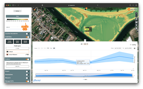
An example of MAPEO used for drone-based monitoring of micro-topography changes in the controlled flooding plains along the river Scheldt.
MAPEO starts as a white-labelled general product (the upper base configuration) but grows over the iterative prototyping phases towards a customer focused platform to guarantee that the specific complexity of the use-cases is addressed adequately. Customers can decide if they use MAPEO as-a-service (a shared instance) or take full ownership of a MAPEO platform instance. In either case, MAPEO can be rebranded according to customers specifications.
Currently, there are multiple MAPEO instances active, each at a different technology readiness level (TRL) depending on the need for further use-case R&D and use-case specific customization of operations. Discover more in our related MAPEO blog posts.
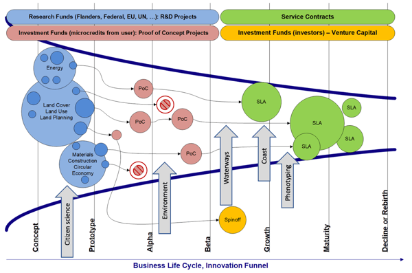
MAPEO starts as a white-labelled base configuration (a first prototype) and ends in a customer-tuned shared or stand-alone instance (grey arrows). Shared instances are managed by the VITO MAPEO group, stand-alone instances are owned and managed by the customer. In either case, shared or stand-alone instances can be branded according to the customer specifications.