Our knowledge in full spectrum
High-Resolution Insights for Land Cover and Forestry Monitoring with Copernicus LCFM
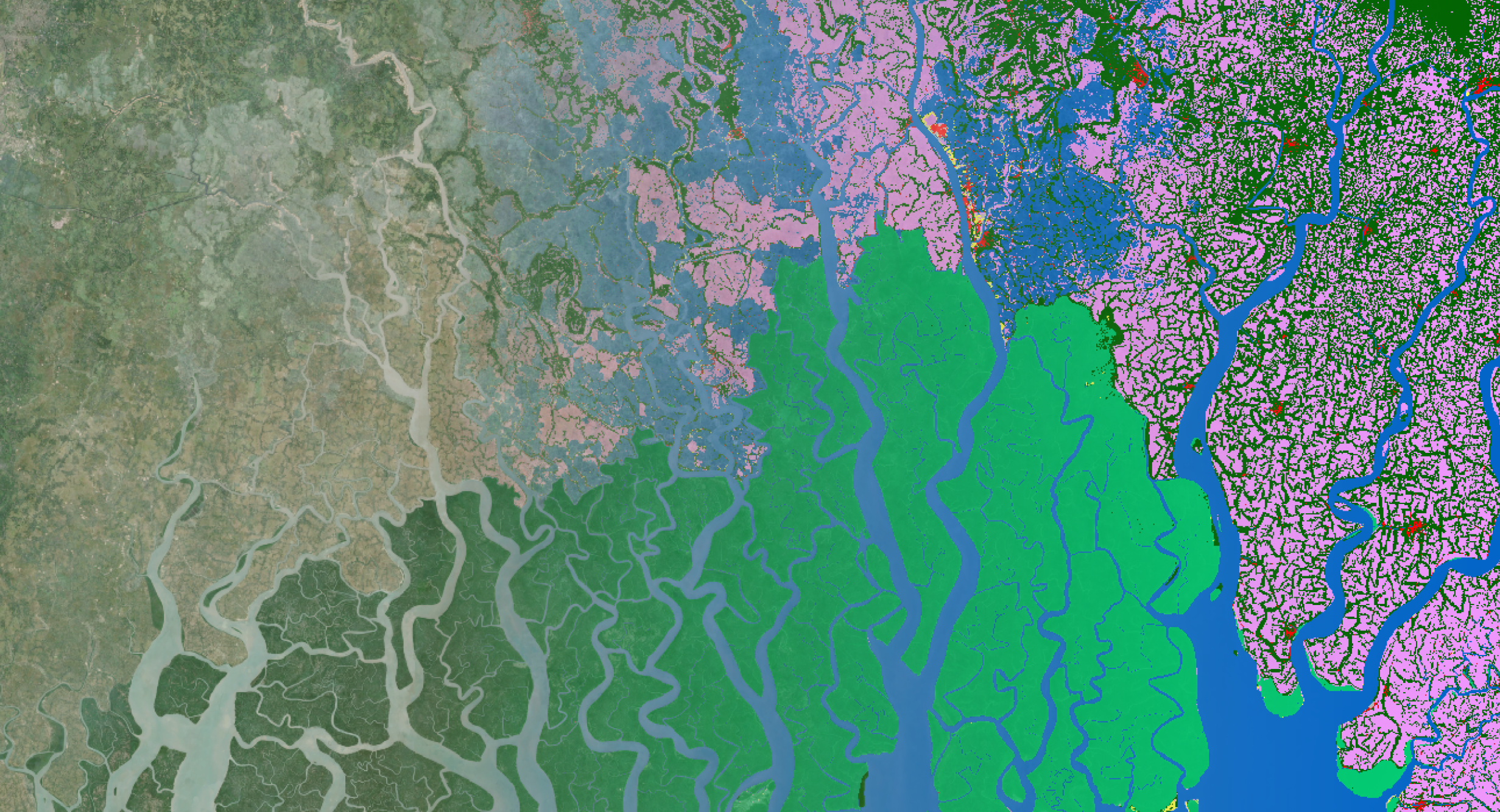
25.09.2025Monitoring global land cover and tropical forests is essential for addressing deforestation, biodiversity loss, and climate change. To support research,..
Read more/Blog_CORSA_1200x650.png)
/Blog_WorldCereal_1200x650.png)
/lewis-latham-0huRqQjz81A-unsplash.jpg)

/boudewijn-huysmans-_iyh6g5KHQA-unsplash.jpg)
/background_image_blog.jpg)
New perspectives in your mailbox
Subscribe to our newsletter.
/CalibrEO%20Service%20Header.jpg)
/Land%20use%20model%20+%20green%20city.png)